
Gelderland
475 known cemeteries in Gelderland, Netherlands.
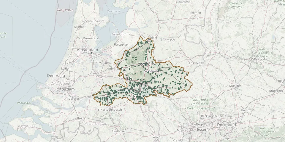 © OpenStreetMap
- Oosterbeek South General CemeteryGPS coordinates: 51.99420° N, 5.85140° E
- Oostergaarde CemeteryGPS coordinates: 52.34837° N, 5.63929° E
- Oosterhout CemeteryGPS coordinates: 51.88216° N, 5.82793° E
- Oosterhout Roman Catholic CemeteryGPS coordinates: 51.87740° N, 5.82670° E
- Oosterwolde General CemeteryGPS coordinates: 52.46048° N, 5.88519° E
- Ophemert General CemeteryGPS coordinates: 51.85245° N, 5.39707° E
- Opijnen General CemeteryGPS coordinates: 51.83285° N, 5.30237° E
- Oude Beekbergerweg Roman Catholic Cemetery, ApeldoornGPS coordinates: 52.19138° N, 5.97053° E
- Oud Zevenaar Roman Catholic ChurchyardGPS coordinates: 51.91506° N, 6.08322° E
- Papesteeg CemeteryGPS coordinates: 51.88287° N, 5.41481° E
- Passmann CemeteryGPS coordinates: 51.96005° N, 6.36556° E
- Peace Rest Dutch Reformed Cemetery, UlftGPS coordinates: 51.89420° N, 6.37480° E
- Plantagehof New General Cemetery, CulemborgGPS coordinates: 51.96409° N, 5.23358° E
- PlantsoensingelGPS coordinates: 51.87840° N, 6.25170° E
- Protestantse kerk HeesseltGPS coordinates: 51.81290° N, 5.34670° E
- Puiflijk CemeteryGPS coordinates: 51.87956° N, 5.58935° E
- Putten New General Cemetery (Engweg Zuid)GPS coordinates: 52.25744° N, 5.60341° E
- Putten Old General Cemetery (Engweg Noord)GPS coordinates: 52.25828° N, 5.60428° E
- Putten Roman Catholic ChurchyardGPS coordinates: 52.26283° N, 5.60756° E
- Randwijk Church CemeteryGPS coordinates: 51.95096° N, 5.70673° E
- Rekken CemeteryGPS coordinates: 52.09377° N, 6.72498° E
- Rheden Heiderust General CemeteryGPS coordinates: 52.00836° N, 6.00779° E
- Rietmolen Churchyard Opposite the ChurchGPS coordinates: 52.13990° N, 6.66270° E
- Rietmolen Roman Catholic Churchyard Behind the ChurchGPS coordinates: 52.14060° N, 6.66170° E
- R.K.begraafpl. MaasbommelGPS coordinates: 51.82100° N, 5.53440° E
- Rosorum CemeteryGPS coordinates: 51.93620° N, 6.06060° E
- Rossum CemeteryGPS coordinates: 51.79943° N, 5.33297° E
- Rustoord CemeteryGPS coordinates: 51.83051° N, 5.88086° E
- Rustoord General CemeteryGPS coordinates: 51.90700° N, 5.78550° E
- Ruurlo CemeteryGPS coordinates: 52.08311° N, 6.45048° E