
Groningen
293 known cemeteries in Groningen, Netherlands.
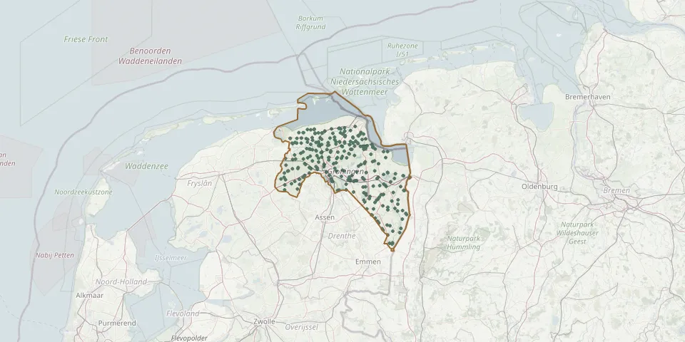 © OpenStreetMap
- Stadskanaal Roman Catholic CemeteryGPS coordinates: 52.99207° N, 6.94703° E
- Stadskanaal Municipal CemeteryGPS coordinates: 53.00617° N, 6.92332° E
- Garrelsweer Reformed Church ChurchyardGPS coordinates: 53.31050° N, 6.75870° E
- Niekerk CemeteryGPS coordinates: 53.22118° N, 6.35133° E
- Kerk van EngelbertGPS coordinates: 53.20896° N, 6.64789° E
- Nieuwe Pekela Reformed Church ChurchyardGPS coordinates: 53.07980° N, 6.96830° E
- Groningen North CemeteryGPS coordinates: 53.23055° N, 6.55233° E
- Grootegast General CemeteryGPS coordinates: 53.20890° N, 6.27390° E
- Eenrum CemeteryGPS coordinates: 53.36349° N, 6.46175° E
- Oude Pekela General CemeteryGPS coordinates: 53.10161° N, 7.01131° E
- Sint-Vituskerk CemeteryGPS coordinates: 53.20030° N, 6.24700° E
- Uniken Family Cemetery, StadskanaalGPS coordinates: 53.03499° N, 6.88353° E
- Zuidhorn General CemeteryGPS coordinates: 53.24000° N, 6.41100° E
- Grootegast Dutch Reformed ChurchyardGPS coordinates: 53.21000° N, 6.27830° E
- Zevenhuizen General CemeteryGPS coordinates: 53.12691° N, 6.34803° E
- Adorp Dutch Reformed CemeteryGPS coordinates: 53.27440° N, 6.53440° E
- Aduard General CemeteryGPS coordinates: 53.25690° N, 6.46280° E
- Agodorp Jewish CemeteryGPS coordinates: 52.87178° N, 7.07701° E
- Alteveer Municipal CemeteryGPS coordinates: 53.04910° N, 7.00540° E
- Andreaskerk CemeteryGPS coordinates: 53.34350° N, 6.71150° E
- Appingedam General CemeteryGPS coordinates: 53.32469° N, 6.85322° E
- Appingedam Jewish CemeteryGPS coordinates: 53.32382° N, 6.85542° E
- Appingedam Rusthof CemeteryGPS coordinates: 53.32374° N, 6.85008° E
- Bad Nieuweschans RusthoflaanGPS coordinates: 53.17988° N, 7.21429° E
- Baflo CemeteryGPS coordinates: 53.36221° N, 6.52329° E
- Baflo (Den Andel) Protestant CemeteryGPS coordinates: 53.38557° N, 6.50962° E
- BartholomeuskerkGPS coordinates: 53.12118° N, 6.66878° E
- Bartholomeuskerk CemeteryGPS coordinates: 53.32220° N, 6.69380° E
- Bedum General CemeteryGPS coordinates: 53.29694° N, 6.60332° E
- Bedum Roman Catholic CemeteryGPS coordinates: 53.30187° N, 6.60609° E