
Groningen
293 known cemeteries in Groningen, Netherlands.
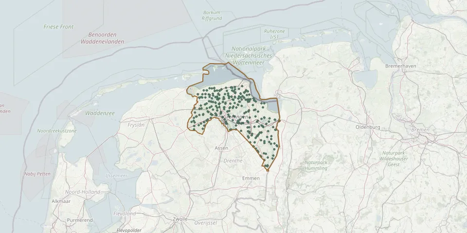 © OpenStreetMap
- Wierum CemeteryGPS coordinates: 53.26820° N, 6.51171° E
- Wierum Terp CemeteryGPS coordinates: 53.26863° N, 6.51157° E
- Wildervank Dutch Reformed Church ChurchyardGPS coordinates: 53.07580° N, 6.85930° E
- Winschoten Old CemeteryGPS coordinates: 53.14397° N, 7.02491° E
- Winschoten Roman Catholic CemeteryGPS coordinates: 53.13772° N, 7.03148° E
- Winsum Jewish CemeteryGPS coordinates: 53.33146° N, 6.53506° E
- Wirdum CemeteryGPS coordinates: 53.32470° N, 6.78750° E
- Wittewierum ChurchyardGPS coordinates: 53.28767° N, 6.74793° E
- Woldendorp CemeteryGPS coordinates: 53.27189° N, 7.02788° E
- Woldendorp CemeteryGPS coordinates: 53.29819° N, 6.53621° E
- Wolfsbarge CemeteryGPS coordinates: 53.12299° N, 6.72283° E
- Wollinghuizen CemeteryGPS coordinates: 52.98700° N, 7.15550° E
- Woltershof General CemeteryGPS coordinates: 53.27072° N, 6.72710° E
- Zandeweer General CemeteryGPS coordinates: 53.38584° N, 6.68014° E
- Zerken rond de kerkGPS coordinates: 53.36030° N, 6.29090° E
- Zerken rond de KerkGPS coordinates: 53.24750° N, 6.86410° E
- Zijldijk CemeteryGPS coordinates: 53.39600° N, 6.75740° E
- Zoutkamp General CemeteryGPS coordinates: 53.33580° N, 6.31144° E
- Zoutkamp Old CemeteryGPS coordinates: 53.33820° N, 6.30710° E
- Zuiderkolonie General CemeteryGPS coordinates: 53.03486° N, 6.93407° E
- Zuidhorn Old CemeteryGPS coordinates: 53.24308° N, 6.40492° E
- Zuidwolde General CemeteryGPS coordinates: 53.26058° N, 6.58926° E
- Zuurdijk CemeteryGPS coordinates: 53.33813° N, 6.37822° E