
Limburg
333 known cemeteries in Limburg, Netherlands.
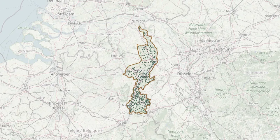 © OpenStreetMap
- Helden CemeteryGPS coordinates: 51.31790° N, 6.00050° E
- Herkenbosch CemeteryGPS coordinates: 51.15530° N, 6.06230° E
- Herten Municipal CemeteryGPS coordinates: 51.18110° N, 5.96460° E
- H. Jacobus de Meerderekerk Roman Catholic CemeteryGPS coordinates: 50.81809° N, 6.00516° E
- H. Michaelkerk Eikske ChurchyardGPS coordinates: 50.88325° N, 6.01187° E
- H. Nicolaas CemeteryGPS coordinates: 51.25271° N, 5.90240° E
- Hoensbroek CemeteryGPS coordinates: 50.92504° N, 5.93897° E
- Holtum CemeteryGPS coordinates: 51.04900° N, 5.82560° E
- Holz Municipal CemeteryGPS coordinates: 50.86343° N, 6.07644° E
- Horn CemeteryGPS coordinates: 51.20790° N, 5.95065° E
- Horn General CemeteryGPS coordinates: 51.21997° N, 5.94964° E
- Horst Old ChurchyardGPS coordinates: 51.45137° N, 6.05241° E
- Horst Roman Catholic CemeteryGPS coordinates: 51.45630° N, 6.05740° E
- Hout Blerick Roman Catholic ChurchyardGPS coordinates: 51.35736° N, 6.12814° E
- Houthem ChurchyardGPS coordinates: 50.87050° N, 5.79760° E
- Hulsberg CemeteryGPS coordinates: 50.89120° N, 5.86950° E
- Hulsberg ChurchyardGPS coordinates: 50.88930° N, 5.86110° E
- Hunsel Roman Catholic ChurchyardGPS coordinates: 51.18836° N, 5.81136° E
- Imstenrade CemeteryGPS coordinates: 50.85547° N, 5.99332° E
- Itteren CemeteryGPS coordinates: 50.89893° N, 5.70013° E
- Ittervoort CemeteryGPS coordinates: 51.16907° N, 5.82458° E
- Jabeek CemeteryGPS coordinates: 50.98163° N, 5.94166° E
- Kaalheide Municipal CemeteryGPS coordinates: 50.86166° N, 6.04077° E
- Kempkensweg Cemetery, LandgraafGPS coordinates: 50.90247° N, 6.01632° E
- Kerensheide CemeteryGPS coordinates: 50.97600° N, 5.76880° E
- Kerk EijsdenGPS coordinates: 50.77860° N, 5.71000° E
- Kerk MargratenGPS coordinates: 50.82040° N, 5.82130° E
- Kerkrade Abbey ChurchyardGPS coordinates: 50.86867° N, 6.08378° E
- Kerkrade-Gracht CemeteryGPS coordinates: 50.85086° N, 6.02766° E
- Kerkrade St. Lambert Church CemeteryGPS coordinates: 50.86537° N, 6.05925° E