
Overijssel
245 known cemeteries in Overijssel, Netherlands.
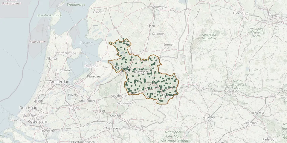 © OpenStreetMap
- Oud-Avereest General CemeteryGPS coordinates: 52.62005° N, 6.37112° E
- Paasloo CemeteryGPS coordinates: 52.82170° N, 5.98910° E
- Paasloo General CemeteryGPS coordinates: 52.81335° N, 6.01353° E
- Parochie O.L. Vr. Onbevlekte Ontvangenis ChurchyardGPS coordinates: 52.56333° N, 5.93356° E
- Peperga CemeteryGPS coordinates: 52.85199° N, 6.05702° E
- Pleegste CemeteryGPS coordinates: 52.35879° N, 6.26698° E
- Raalte Heritage ChurchyardGPS coordinates: 52.38595° N, 6.29417° E
- Raalte Jewish CemeteryGPS coordinates: 52.38285° N, 6.26785° E
- Raalte Roman Catholic CemeteryGPS coordinates: 52.38909° N, 6.27333° E
- Reutum Roman Catholic Church CemeteryGPS coordinates: 52.39050° N, 6.84440° E
- Rijssen Jewish CemeteryGPS coordinates: 52.29277° N, 6.51910° E
- Rijssen Old Municipal CemeteryGPS coordinates: 52.30552° N, 6.52465° E
- Rijssen Roman Catholic CemeteryGPS coordinates: 52.30654° N, 6.52957° E
- R. K. CemeteryGPS coordinates: 52.51058° N, 6.26040° E
- Rossum Roman Catholic CemeteryGPS coordinates: 52.35199° N, 6.92171° E
- Rouveen Dutch Reformed ChurchyardGPS coordinates: 52.61517° N, 6.18701° E
- Rouveen General CemeteryGPS coordinates: 52.61491° N, 6.19091° E
- Rouveen New General CemeteryGPS coordinates: 52.61571° N, 6.18429° E
- Ruitenborgh General CemeteryGPS coordinates: 52.50669° N, 6.25021° E
- Rust Zacht Municipal CemeteryGPS coordinates: 52.40114° N, 6.15145° E
- Saasveld Roman Catholic CemeteryGPS coordinates: 52.33001° N, 6.80992° E
- Scheerwolde CemeteryGPS coordinates: 52.75770° N, 6.01300° E
- Scholtensdijk CemeteryGPS coordinates: 52.56910° N, 6.60220° E
- Sibculo CemeteryGPS coordinates: 52.48242° N, 6.64195° E
- Sint Isidorushoeve Roman Catholic CemeteryGPS coordinates: 52.17750° N, 6.70164° E
- Slagharen Roman Catholic CemeteryGPS coordinates: 52.62765° N, 6.55635° E
- Staphorst CemeteryGPS coordinates: 52.64540° N, 6.20660° E
- Steenbrugge CemeteryGPS coordinates: 52.27433° N, 6.17775° E
- Steenwijkerwold General CemeteryGPS coordinates: 52.82668° N, 6.07063° E
- Steenwijkerwold Roman Catholic CemeteryGPS coordinates: 52.80096° N, 6.05901° E