
Overijssel
245 known cemeteries in Overijssel, Netherlands.
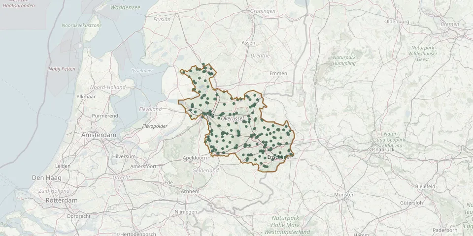 © OpenStreetMap
- Herfte-Wijthmen Roman Catholic ChurchyardGPS coordinates: 52.49641° N, 6.16088° E
- Hertme Roman Catholic CemeteryGPS coordinates: 52.32029° N, 6.75907° E
- Het Kleine Blik Natural Burial GroundGPS coordinates: 52.37650° N, 6.45496° E
- Het Lentfert CemeteryGPS coordinates: 52.30038° N, 6.53647° E
- Het Stift Reformed Cemetery, WeerseloGPS coordinates: 52.35500° N, 6.84090° E
- H. Gerardus Majella CemeteryGPS coordinates: 52.24043° N, 7.03106° E
- Holten Canadian War CemeteryGPS coordinates: 52.29954° N, 6.42889° E
- Holten General CemeteryGPS coordinates: 52.28301° N, 6.42408° E
- Holten New General Cemetery (new section)GPS coordinates: 52.28360° N, 6.40833° E
- IJhorst CemeteryGPS coordinates: 52.66400° N, 6.28582° E
- IJpenhof CemeteryGPS coordinates: 52.82118° N, 6.14108° E
- IJsselmuiden de Zandberg General CemeteryGPS coordinates: 52.56881° N, 5.93502° E
- IJsselmuiden Jewish CemeteryGPS coordinates: 52.56974° N, 5.93415° E
- IJsselmuiden Roman Catholic CemeteryGPS coordinates: 52.57030° N, 5.93550° E
- Israelitisch ChurchyardGPS coordinates: 52.26154° N, 6.72690° E
- JodenbergjeGPS coordinates: 52.58271° N, 6.62947° E
- Kallenkote Old General CemeteryGPS coordinates: 52.78628° N, 6.15301° E
- Kerkbuurt CemeteryGPS coordinates: 52.80396° N, 6.06678° E
- Kerspel Jewish CemeteryGPS coordinates: 52.21016° N, 6.55172° E
- Kuinre New General CemeteryGPS coordinates: 52.79529° N, 5.84014° E
- Kuinre Old General CemeteryGPS coordinates: 52.79565° N, 5.83984° E
- Kuinre Roman Catholic CemeteryGPS coordinates: 52.79593° N, 5.83931° E
- Laarmanshoek CemeteryGPS coordinates: 52.51161° N, 6.39810° E
- Langeveen CemeteryGPS coordinates: 52.47020° N, 6.71310° E
- Lattrop Roman Catholic CemeteryGPS coordinates: 52.42872° N, 6.97967° E
- Lemele Natural Burial GroundGPS coordinates: 52.45317° N, 6.42248° E
- Lemelerveld CemeteryGPS coordinates: 52.43890° N, 6.34140° E
- Lemelerveld Roman Catholic CemeteryGPS coordinates: 52.44402° N, 6.33595° E
- Lettele CemeteryGPS coordinates: 52.27770° N, 6.27140° E
- Lonneker Roman Catholic CemeteryGPS coordinates: 52.25003° N, 6.91298° E