
Łódź Voivodeship
732 known cemeteries in Łódź Voivodeship, Poland.
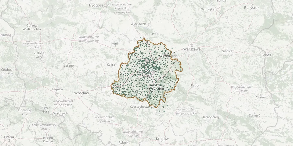 © OpenStreetMap
- Trojanowice Cholera CemeteryGPS coordinates: 51.25416° N, 20.17312° E
- Truszczanek Evangelical CemeteryGPS coordinates: 51.28214° N, 19.56425° E
- Trzas Evangelical Reformed CemeteryGPS coordinates: 51.21944° N, 19.27939° E
- Trząs Former Evangelical CemeteryGPS coordinates: 51.29028° N, 19.21989° E
- Tubądzin Roman Catholic CemeteryGPS coordinates: 51.65895° N, 18.56123° E
- Tuszyn Evangelical CemeteryGPS coordinates: 51.60233° N, 19.53285° E
- Tuszyn Jewish CemeteryGPS coordinates: 51.61347° N, 19.50559° E
- Tyble CemeteryGPS coordinates: 51.30543° N, 18.31520° E
- Uniejów Jewish CemeteryGPS coordinates: 51.98168° N, 18.79571° E
- Uników CemeteryGPS coordinates: 51.40355° N, 18.54459° E
- Wągłczew St. Clement Parish CemeteryGPS coordinates: 51.59507° N, 18.53993° E
- Walichnowy Roman Catholic CemeteryGPS coordinates: 51.29421° N, 18.37532° E
- Warta Jewish CemeteryGPS coordinates: 51.71597° N, 18.62192° E
- Warta Roman Catholic CemeteryGPS coordinates: 51.70122° N, 18.61858° E
- Węglewice New CemeteryGPS coordinates: 51.38938° N, 18.21324° E
- Węglewice Old CemeteryGPS coordinates: 51.39221° N, 18.20982° E
- Wiączyn Górny Lutheran CemeteryGPS coordinates: 51.76327° N, 19.61488° E
- Wiączyn War Cemetery from the Battle of ŁódźGPS coordinates: 51.77148° N, 19.62976° E
- Wielenin Epidemic CemeteryGPS coordinates: 52.01085° N, 18.84561° E
- Wielenin Roman Catholic CemeteryGPS coordinates: 52.02141° N, 18.84034° E
- Wielgomłyny CemeteryGPS coordinates: 51.00926° N, 19.77859° E
- Wielka Wieś Evangelical CemeteryGPS coordinates: 51.68414° N, 18.96665° E
- Wielka Wieś Roman Catholic CemeteryGPS coordinates: 51.68485° N, 18.96672° E
- Wieluń Jewish CemeteryGPS coordinates: 51.21276° N, 18.55330° E
- Wieluń Lutheran CemeteryGPS coordinates: 51.21894° N, 18.58389° E
- Wieluń Municipal CemeteryGPS coordinates: 51.21156° N, 18.57152° E
- Wieluń Roman Catholic CemeteryGPS coordinates: 51.21254° N, 18.56951° E
- Wieruszów Denominational Cemetery (now Roman Catholic)GPS coordinates: 51.29109° N, 18.15902° E
- Wieruszów Jewish CemeteryGPS coordinates: 51.29900° N, 18.17400° E
- Wierzchlas Parish CemeteryGPS coordinates: 51.20110° N, 18.66213° E