
Łódź Voivodeship
732 known cemeteries in Łódź Voivodeship, Poland.
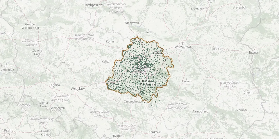 © OpenStreetMap
- Wierzchy Roman Catholic CemeteryGPS coordinates: 51.81163° N, 18.89298° E
- Wiewiec ChurchyardGPS coordinates: 51.12944° N, 19.22902° E
- Wilamów Epidemic CemeteryGPS coordinates: 52.05262° N, 18.76870° E
- Wilamów Parish CemeteryGPS coordinates: 52.04707° N, 18.75912° E
- Wilczyca Evangelical CemeteryGPS coordinates: 51.85177° N, 19.04827° E
- Wilków Evangelical CemeteryGPS coordinates: 51.83388° N, 19.06012° E
- Wiskitki War CemeteryGPS coordinates: 52.08617° N, 20.37067° E
- Witów Parish CemeteryGPS coordinates: 51.37398° N, 19.74538° E
- Władysławów Evangelical CemeteryGPS coordinates: 51.97986° N, 19.49943° E
- Włodzimierzów Parish CemeteryGPS coordinates: 51.35470° N, 19.83093° E
- Włoszczowa Municipal CemeteryGPS coordinates: 50.86780° N, 19.96223° E
- Włoszczowa Parish CemeteryGPS coordinates: 50.75809° N, 19.99927° E
- Wójcin Parish CemeteryGPS coordinates: 51.33523° N, 20.02432° E
- Wójcin St. Catherine Parish CemeteryGPS coordinates: 51.18020° N, 18.23784° E
- Wojków CemeteryGPS coordinates: 51.58808° N, 18.42843° E
- Wojskowy, ŁowiczGPS coordinates: 52.11460° N, 19.94566° E
- Wola Cyrusowa Mariavite CemeteryGPS coordinates: 51.87105° N, 19.76387° E
- Wola Kamocka Roman Catholic CemeteryGPS coordinates: 51.47434° N, 19.56009° E
- Wola Krzysztoporska Parish CemeteryGPS coordinates: 51.33896° N, 19.58073° E
- Wola Pierowa Roman Catholic CemeteryGPS coordinates: 52.32809° N, 19.18295° E
- Wola Szydłowiecka War Cemetery from World War IGPS coordinates: 52.07103° N, 20.23965° E
- Wola Szydłowiecka War Cemetery from World War IGPS coordinates: 52.07348° N, 20.22942° E
- Wola Wiązowa CemeteryGPS coordinates: 51.33117° N, 18.90815° E
- Wola Wysoka Roman Catholic CemeteryGPS coordinates: 51.86928° N, 20.12352° E
- Wolbórz CemeteryGPS coordinates: 51.51138° N, 19.83903° E
- Wólka Łasiecka War Cemetery 1914-1915GPS coordinates: 52.05953° N, 20.14810° E
- Wólka Prusicka Roman Catholic CemeteryGPS coordinates: 51.01733° N, 19.11787° E
- Woźniaków Parish CemeteryGPS coordinates: 52.22620° N, 19.30783° E
- Wróblew CemeteryGPS coordinates: 51.14998° N, 18.41088° E
- Wroczyny Evangelical CemeteryGPS coordinates: 52.20910° N, 19.27928° E