
Lublin Voivodeship
1,041 known cemeteries in Lublin Voivodeship, Poland.
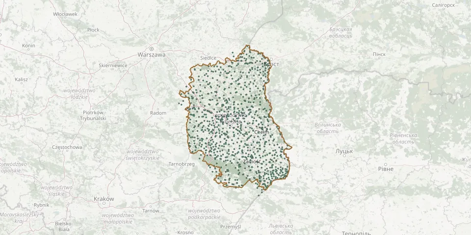 © OpenStreetMap
- Kurów New Jewish CemeteryGPS coordinates: 51.38863° N, 22.17707° E
- Kurów War CemeteryGPS coordinates: 51.38680° N, 22.20290° E
- Kużawka War Cemetery (World War I)GPS coordinates: 52.10931° N, 23.54809° E
- Łabunie Parish CemeteryGPS coordinates: 50.66027° N, 23.36054° E
- Łabunie Roman Catholic CemeteryGPS coordinates: 50.65000° N, 23.38646° E
- Lack CemeteryGPS coordinates: 51.65617° N, 23.43445° E
- Łańcuchów Parish CemeteryGPS coordinates: 51.26862° N, 22.91317° E
- Łańcuchów War Cemetery from World War IGPS coordinates: 51.26957° N, 22.91578° E
- Łapiguz War Cemetery, ŁukówGPS coordinates: 51.92886° N, 22.34781° E
- Lasek Parish CemeteryGPS coordinates: 50.92268° N, 21.84748° E
- Łaszczów Jewish CemeteryGPS coordinates: 50.53268° N, 23.72047° E
- Łaszczówka-Kolonia Parish CemeteryGPS coordinates: 50.41951° N, 23.41899° E
- Łaszczówka-Kolonia World War I CemeteryGPS coordinates: 50.41828° N, 23.42950° E
- Łaszczówka Parish CemeteryGPS coordinates: 50.44043° N, 23.45745° E
- Łaszczów Parish CemeteryGPS coordinates: 50.53539° N, 23.73809° E
- Łaziska Old Orthodox CemeteryGPS coordinates: 50.80680° N, 23.38224° E
- Łaziska Parish CemeteryGPS coordinates: 50.81063° N, 23.38504° E
- Lebiedziew Tatar Muslim CemeteryGPS coordinates: 52.01322° N, 23.57462° E
- Łęczna Jewish CemeteryGPS coordinates: 51.30126° N, 22.87425° E
- Łęczna Parish CemeteryGPS coordinates: 51.29832° N, 22.88964° E
- Leitnie Parish CemeteryGPS coordinates: 51.60504° N, 23.00521° E
- Leniuszki Orthodox CemeteryGPS coordinates: 51.86944° N, 23.50528° E
- Leokadiów German Colonists' Evangelical CemeteryGPS coordinates: 51.41178° N, 21.80622° E
- Leopoldów Parish CemeteryGPS coordinates: 51.66718° N, 22.00370° E
- Leśna Podlaska Roman Catholic CemeteryGPS coordinates: 52.12470° N, 23.03486° E
- Leśniowice Polish Catholic CemeteryGPS coordinates: 50.98703° N, 23.50657° E
- Leszkowice Parish CemeteryGPS coordinates: 51.54574° N, 22.62205° E
- Lipa Parish CemeteryGPS coordinates: 50.70414° N, 22.07835° E
- Lipina Nowa World War I CemeteryGPS coordinates: 50.84333° N, 23.41463° E
- Lipiny Górne-Borowina Parish CemeteryGPS coordinates: 50.42126° N, 22.49749° E