
Lublin Voivodeship
1,041 known cemeteries in Lublin Voivodeship, Poland.
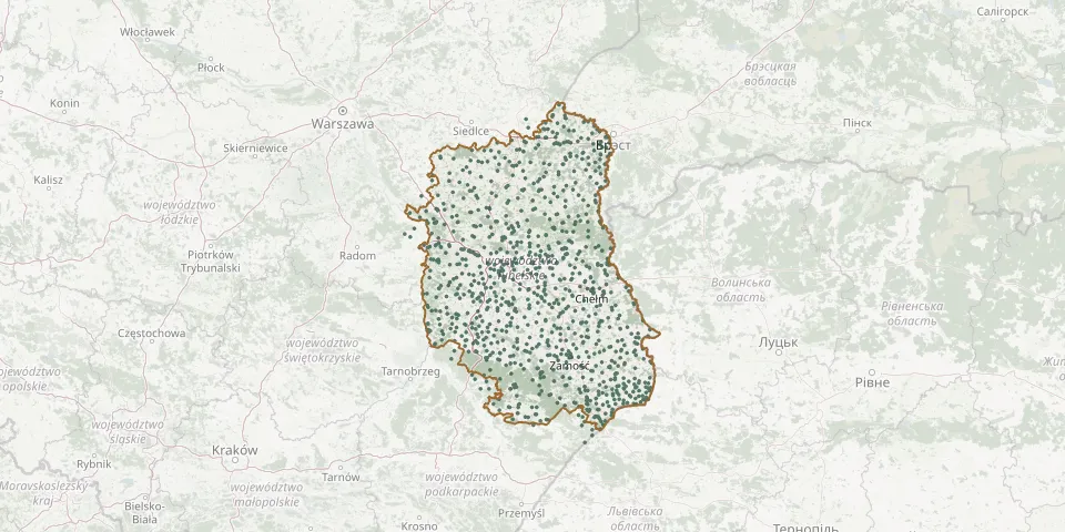 © OpenStreetMap
- Okczyn Orthodox and Catholic Parish CemeteryGPS coordinates: 51.95704° N, 23.62829° E
- Okrzeja Roman Catholic CemeteryGPS coordinates: 51.73804° N, 22.09525° E
- Olbięcin World War I War CemeteryGPS coordinates: 50.87211° N, 22.11431° E
- Olchowiec Parish CemeteryGPS coordinates: 51.23782° N, 23.28137° E
- Olchowiec Parish CemeteryGPS coordinates: 50.93198° N, 22.92148° E
- Olszanki Orthodox CemeteryGPS coordinates: 51.89332° N, 23.54479° E
- Opoka Duża War Cemetery (World Wars I and II)GPS coordinates: 50.87188° N, 21.85456° E
- Opole Lubelskie Jewish Cemetery (old)GPS coordinates: 51.14546° N, 21.95612° E
- Orchówek Denominational Cemetery (now Roman Catholic)GPS coordinates: 51.52104° N, 23.58007° E
- Orchowiec Parish CemeteryGPS coordinates: 50.98776° N, 22.94209° E
- Orłów Murowany-Kolonia Parish CemeteryGPS coordinates: 50.89521° N, 23.23937° E
- Ortel Królewski Drugi CemeteryGPS coordinates: 51.95880° N, 23.25857° E
- Ortel Książęcy Pierwszy Orthodox CemeteryGPS coordinates: 51.97588° N, 23.25628° E
- Ortel Książęcy Pierwszy Roman Catholic CemeteryGPS coordinates: 51.97554° N, 23.25470° E
- Orzechów Stary War Cemetery (World War I)GPS coordinates: 51.47171° N, 23.01664° E
- Orzechów Stary War Cemetery (World War I)GPS coordinates: 51.47681° N, 23.01785° E
- Osowa German-Speaking Baptists' CemeteryGPS coordinates: 51.04157° N, 22.57368° E
- Osowa Jewish CemeteryGPS coordinates: 51.40921° N, 23.53498° E
- Osowce North CemeteryGPS coordinates: 51.68823° N, 23.50243° E
- Ostrówek-Kolonia Old CemeteryGPS coordinates: 51.59246° N, 22.62060° E
- Ostrówek Parish CemeteryGPS coordinates: 51.59234° N, 22.62216° E
- Ostrówki Roman Catholic CemeteryGPS coordinates: 51.82410° N, 22.81155° E
- Ostrów Lubelski Jewish CemeteryGPS coordinates: 51.50220° N, 22.85440° E
- Ostrów Lubelski Parish CemeteryGPS coordinates: 51.49224° N, 22.84613° E
- Osuchy War CemeteryGPS coordinates: 50.47980° N, 22.94999° E
- Oszczów Parish CemeteryGPS coordinates: 50.55030° N, 24.02998° E
- Otrocz Parish CemeteryGPS coordinates: 50.82044° N, 22.58800° E
- Pałecznica Parish CemeteryGPS coordinates: 51.48888° N, 22.67869° E
- Palikije Pierwsze Parish CemeteryGPS coordinates: 51.22700° N, 22.29798° E
- Pańków Parish CemeteryGPS coordinates: 50.51309° N, 23.34561° E