
Lublin Voivodeship
1,041 known cemeteries in Lublin Voivodeship, Poland.
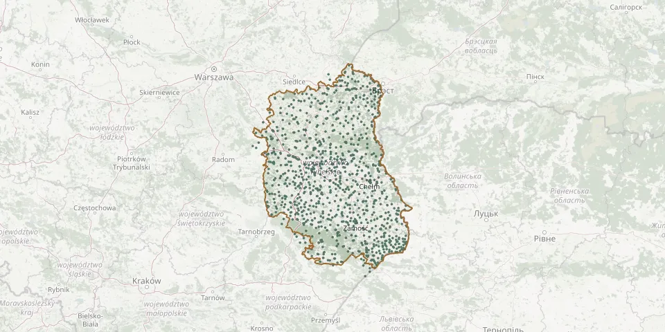 © OpenStreetMap
- Horodło Catholic CemeteryGPS coordinates: 50.88845° N, 24.04712° E
- Huta Krzeszowska CemeteryGPS coordinates: 50.51687° N, 22.45321° E
- Kniazie CemeteryGPS coordinates: 50.33727° N, 23.49477° E
- Korytków Duży Parish CemeteryGPS coordinates: 50.61122° N, 22.67230° E
- Nielisz Parish CemeteryGPS coordinates: 50.78762° N, 23.04381° E
- Stara Huta CemeteryGPS coordinates: 50.28398° N, 23.37246° E
- Tarnogród CemeteryGPS coordinates: 50.36293° N, 22.73388° E
- Zagłoba Parish CemeteryGPS coordinates: 51.21047° N, 21.86196° E
- Zamość Parish CemeteryGPS coordinates: 50.72068° N, 23.26205° E
- Adamów Jewish CemeteryGPS coordinates: 51.74760° N, 22.28180° E
- Adamów Roman Catholic CemeteryGPS coordinates: 51.74820° N, 22.26035° E
- Adelina World War I CemeteryGPS coordinates: 51.14601° N, 22.14462° E
- Aleksandrówka Parish CemeteryGPS coordinates: 50.87204° N, 22.44659° E
- Andrzejów Parish CemeteryGPS coordinates: 50.75540° N, 22.43017° E
- Annobór-Kolonia War CemeteryGPS coordinates: 51.44268° N, 22.58439° E
- Annopol New Jewish CemeteryGPS coordinates: 50.88724° N, 21.85053° E
- Annopol Parish CemeteryGPS coordinates: 50.88100° N, 21.87142° E
- Antonin Stary German Colonists' CemeteryGPS coordinates: 51.58921° N, 22.44314° E
- Assumption of the Blessed Virgin Mary Parish Cemetery, KraśnikGPS coordinates: 50.92104° N, 22.21032° E
- Babice New CemeteryGPS coordinates: 50.35529° N, 22.92151° E
- Babice Old CemeteryGPS coordinates: 50.35463° N, 22.91080° E
- Babin Parish CemeteryGPS coordinates: 51.17732° N, 22.35109° E
- Balonna War Cemetery, DęblinGPS coordinates: 51.55068° N, 21.84733° E
- Baranów Jewish CemeteryGPS coordinates: 51.55436° N, 22.13930° E
- Batorz Pierwszy Parish CemeteryGPS coordinates: 50.84922° N, 22.49933° E
- Bełżec Epidemic CemeteryGPS coordinates: 50.38609° N, 23.42407° E
- Bełżyce Jewish CemeteryGPS coordinates: 51.16354° N, 22.28076° E
- Bełżyce Roman Catholic CemeteryGPS coordinates: 51.16799° N, 22.27741° E
- Biała Podlaska Italian War Cemetery from World War IIGPS coordinates: 52.02983° N, 23.15600° E
- Biała Podlaska Jewish CemeteryGPS coordinates: 52.03940° N, 23.11966° E