
Opole Voivodeship
690 known cemeteries in Opole Voivodeship, Poland.
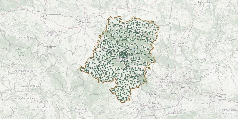 © OpenStreetMap
- Praszka Parish CemeteryGPS coordinates: 51.05960° N, 18.45456° E
- Żytniów Parish CemeteryGPS coordinates: 51.01150° N, 18.57551° E
- Rudniki Parish CemeteryGPS coordinates: 51.04172° N, 18.59566° E
- Olesno CemeteryGPS coordinates: 50.89608° N, 18.42260° E
- Jaworzno Parish CemeteryGPS coordinates: 51.03130° N, 18.64837° E
- Bierawa CemeteryGPS coordinates: 50.28040° N, 18.23913° E
- Strojec Parish CemeteryGPS coordinates: 51.04125° N, 18.49070° E
- Kluczbork Municipal CemeteryGPS coordinates: 50.96479° N, 18.21935° E
- Płużnica Wielka Old Parish CemeteryGPS coordinates: 50.47227° N, 18.46852° E
- Chróścina Parish CemeteryGPS coordinates: 50.76201° N, 17.68132° E
- Goszczowice CemeteryGPS coordinates: 50.56688° N, 17.61364° E
- Nowy Świętów CemeteryGPS coordinates: 50.36948° N, 17.36871° E
- St. Joseph Parish Cemetery, BaborówGPS coordinates: 50.16175° N, 17.98393° E
- Lewin Brzeski CemeteryGPS coordinates: 50.75265° N, 17.60608° E
- Małujowice Parish CemeteryGPS coordinates: 50.84288° N, 17.36690° E
- Gierałtowice CemeteryGPS coordinates: 50.27016° N, 18.09279° E
- Gosławice Municipal Cemetery, Opole (Hubala / Brzozowa)GPS coordinates: 50.68196° N, 17.95012° E
- Nowy Świętów Old CemeteryGPS coordinates: 50.36830° N, 17.36188° E
- Podlesie CemeteryGPS coordinates: 50.28053° N, 17.35407° E
- Półwieś Central Municipal Cemetery, OpoleGPS coordinates: 50.67609° N, 17.87808° E
- Opole Lutheran CemeteryGPS coordinates: 50.67483° N, 17.90727° E
- Lubsza Parish CemeteryGPS coordinates: 50.91679° N, 17.51839° E
- Brzeg Municipal CemeteryGPS coordinates: 50.85733° N, 17.48655° E
- Michałowice Parish CemeteryGPS coordinates: 50.89311° N, 17.48494° E
- Puszyna CemeteryGPS coordinates: 50.45741° N, 17.62534° E
- Tułowice CemeteryGPS coordinates: 50.59302° N, 17.65059° E
- Opole Gosławice Parish CemeteryGPS coordinates: 50.68270° N, 17.97229° E
- Komorzno CemeteryGPS coordinates: 51.11821° N, 18.07496° E
- Ściborzyce Wielkie Lutheran Parish CemeteryGPS coordinates: 50.02045° N, 18.03351° E
- Stare Koźle Parish ChurchyardGPS coordinates: 50.30669° N, 18.21735° E