
Opole Voivodeship
690 known cemeteries in Opole Voivodeship, Poland.
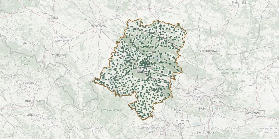 © OpenStreetMap
- Stary Grodków Roman Catholic CemeteryGPS coordinates: 50.65614° N, 17.38896° E
- Stary Las German CemeteryGPS coordinates: 50.37997° N, 17.40615° E
- Stary Las Roman Catholic CemeteryGPS coordinates: 50.38211° N, 17.40984° E
- Stary Paczków Roman Catholic CemeteryGPS coordinates: 50.45487° N, 17.04476° E
- Stary Ujazd Roman Catholic CemeteryGPS coordinates: 50.40444° N, 18.34111° E
- St. Catherine of Alexandria Parish Cemetery, Kędzierzyn-KoźleGPS coordinates: 50.38159° N, 18.31246° E
- St. Catherine of Alexandria Parish Cemetery, ŁąkaGPS coordinates: 50.39277° N, 17.21141° E
- Steblów Parish Churchyard (Krapkowice County)GPS coordinates: 50.45422° N, 17.93056° E
- Sternalice Cemetery (Sternalitz Cemetery)GPS coordinates: 50.97226° N, 18.55273° E
- St. Joseph the Worker Parish Cemetery, OsowiecGPS coordinates: 50.75467° N, 18.01808° E
- Stobrawa Roman Catholic CemeteryGPS coordinates: 50.84974° N, 17.63130° E
- Stradunia Roman Catholic CemeteryGPS coordinates: 50.41343° N, 18.04636° E
- Streszowice Former CemeteryGPS coordinates: 50.73122° N, 17.59749° E
- St. Roch Parish Cemetery, Stare BudkowiceGPS coordinates: 50.86428° N, 18.05814° E
- Strzelce Opolskie Evangelical CemeteryGPS coordinates: 50.51307° N, 18.30728° E
- Strzelce Opolskie Municipal CemeteryGPS coordinates: 50.51171° N, 18.26577° E
- Strzelce Opolskie Parish CemeteryGPS coordinates: 50.51302° N, 18.29112° E
- Strzelce Roman Catholic CemeteryGPS coordinates: 51.06453° N, 17.84821° E
- Strzeleczki Parish CemeteryGPS coordinates: 50.45704° N, 17.85752° E
- Strzelniki Parish CemeteryGPS coordinates: 50.80645° N, 17.54286° E
- St. Valentin CemeteryGPS coordinates: 50.72940° N, 18.44000° E
- Sucha CemeteryGPS coordinates: 50.55798° N, 18.22361° E
- Sucha Psina Municipal CemeteryGPS coordinates: 50.11915° N, 17.92020° E
- Suchy Bór Municipal CemeteryGPS coordinates: 50.65061° N, 18.04461° E
- Suliszów CemeteryGPS coordinates: 50.52122° N, 17.12995° E
- Świerczów Evangelical Cemetery (now Roman Catholic)GPS coordinates: 50.96520° N, 17.75141° E
- Świniary Wielkie Parish CemeteryGPS coordinates: 51.06460° N, 18.00111° E
- Szemrowice CemeteryGPS coordinates: 50.75380° N, 18.38800° E
- Szklary Roman Catholic CemeteryGPS coordinates: 50.60442° N, 17.18110° E
- Szonów CemeteryGPS coordinates: 50.30807° N, 17.84097° E