
Opole Voivodeship
690 known cemeteries in Opole Voivodeship, Poland.
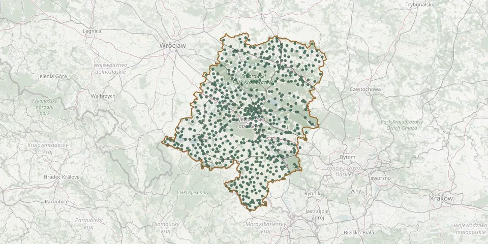 © OpenStreetMap
- Exaltation of the Holy Cross Parish Cemetery, Smardy GórneGPS coordinates: 50.99847° N, 18.16358° E
- Fałkowice Parish CemeteryGPS coordinates: 50.96470° N, 17.86767° E
- Gaj CemeteryGPS coordinates: 50.50738° N, 18.39829° E
- Gałązczyce Roman Catholic CemeteryGPS coordinates: 50.68907° N, 17.28231° E
- Gana Parish CemeteryGPS coordinates: 51.06808° N, 18.53739° E
- Gierałcice Evangelical ChurchyardGPS coordinates: 50.98977° N, 18.04711° E
- Gierałcice Roman Catholic CemeteryGPS coordinates: 50.33683° N, 17.31907° E
- Gierszowice Parish CemeteryGPS coordinates: 50.81103° N, 17.50231° E
- Głębinów Roman Catholic ChurchyardGPS coordinates: 50.46421° N, 17.27189° E
- Głogówek Jewish CemeteryGPS coordinates: 50.36755° N, 17.86680° E
- Głogówek Roman Catholic ChurchyardGPS coordinates: 50.35078° N, 17.85920° E
- Głubczyce Jewish CemeteryGPS coordinates: 50.21008° N, 17.82335° E
- Głubczyce Municipal CemeteryGPS coordinates: 50.20890° N, 17.82277° E
- Głuchołazy Communal CemeteryGPS coordinates: 50.31608° N, 17.39267° E
- Głuszyna All Saints Parish CemeteryGPS coordinates: 51.15984° N, 17.82086° E
- Głuszyna Old ChurchyardGPS coordinates: 51.16156° N, 17.81948° E
- Gogolin Jewish CemeteryGPS coordinates: 50.48689° N, 18.01768° E
- Gogolin Sacred Heart of Jesus Parish CemeteryGPS coordinates: 50.49019° N, 18.03046° E
- Gola Roman Catholic CemeteryGPS coordinates: 50.95351° N, 17.70660° E
- Goła Roman Catholic CemeteryGPS coordinates: 51.07184° N, 18.37502° E
- Golczowice Protestant Cemetery, now Roman CatholicGPS coordinates: 50.77235° N, 17.73088° E
- Golczowice Roman Catholic ChurchyardGPS coordinates: 50.39441° N, 17.79883° E
- Gołuszowice Municipal CemeteryGPS coordinates: 50.20353° N, 17.78393° E
- Góra Former Evangelical CemeteryGPS coordinates: 50.67336° N, 17.56269° E
- Góra Świętej Anny CemeteryGPS coordinates: 50.45578° N, 18.17066° E
- Górażdże Blessed Ceslaus Parish CemeteryGPS coordinates: 50.53164° N, 18.01317° E
- Górka Municipal CemeteryGPS coordinates: 50.49717° N, 17.35041° E
- Górki Municipal CemeteryGPS coordinates: 50.62928° N, 17.89348° E
- Gorzów Śląski Roman Catholic CemeteryGPS coordinates: 51.02861° N, 18.41391° E
- Gościce Roman Catholic CemeteryGPS coordinates: 50.43221° N, 16.97810° E