
Podlaskie Voivodeship
670 known cemeteries in Podlaskie Voivodeship, Poland.
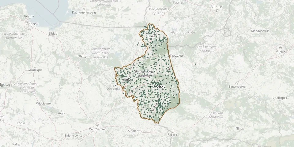 © OpenStreetMap
- Puchały Orthodox CemeteryGPS coordinates: 52.91218° N, 23.39379° E
- Puchały Parish CemeteryGPS coordinates: 53.08108° N, 22.22458° E
- Puchły ChurchyardGPS coordinates: 52.91300° N, 23.40110° E
- Pulsze Catholic CemeteryGPS coordinates: 52.85189° N, 23.03033° E
- Puńsk Evangelical CemeteryGPS coordinates: 54.24976° N, 23.17016° E
- Puńsk Historic Jewish CemeteryGPS coordinates: 54.25105° N, 23.16720° E
- Puńsk Old Roman Catholic CemeteryGPS coordinates: 54.24748° N, 23.18035° E
- Puńsk Roman Catholic Parish CemeteryGPS coordinates: 54.24943° N, 23.19040° E
- Raczki Parish CemeteryGPS coordinates: 53.99323° N, 22.77763° E
- Radule Parish CemeteryGPS coordinates: 53.14535° N, 22.81186° E
- Radunin CemeteryGPS coordinates: 53.15895° N, 23.57528° E
- Radzilow Roman Catholic CemeteryGPS coordinates: 53.41397° N, 22.40940° E
- Rajgród New Parish CemeteryGPS coordinates: 53.72659° N, 22.68263° E
- Rajgród Old Parish CemeteryGPS coordinates: 53.73033° N, 22.69968° E
- Rajki Orthodox CemeteryGPS coordinates: 52.71046° N, 23.19961° E
- Rajsk Orthodox CemeteryGPS coordinates: 52.84980° N, 23.16507° E
- Rakowo Chmielewo World War I CemeteriesGPS coordinates: 53.34892° N, 21.99347° E
- Rogacze Orthodox CemeteryGPS coordinates: 52.50910° N, 23.22165° E
- Rogawka Orthodox CemeteryGPS coordinates: 52.43613° N, 22.78634° E
- Romanówka Old Believers' CemeteryGPS coordinates: 54.21678° N, 22.64611° E
- Romany Municipal CemeteryGPS coordinates: 53.40492° N, 22.24560° E
- Rosochate Kościelne Parish CemeteryGPS coordinates: 52.85748° N, 22.34776° E
- Rosochaty Róg Old Believers' CemeteryGPS coordinates: 54.05306° N, 23.10528° E
- Różanystok Parish CemeteryGPS coordinates: 53.63005° N, 23.39517° E
- Rozedranka Old Parish CemeteryGPS coordinates: 53.37560° N, 23.33764° E
- Ruda War Cemetery (World War I)GPS coordinates: 53.59353° N, 22.52075° E
- Rudawka Roman Catholic CemeteryGPS coordinates: 53.86856° N, 23.50842° E
- Rudka ChurchyardGPS coordinates: 52.72167° N, 22.73154° E
- Rudka Parish CemeteryGPS coordinates: 52.71107° N, 22.73620° E
- Rudka Skroda War Cemetery (World War I)GPS coordinates: 53.28439° N, 21.89641° E