
Podlaskie Voivodeship
670 known cemeteries in Podlaskie Voivodeship, Poland.
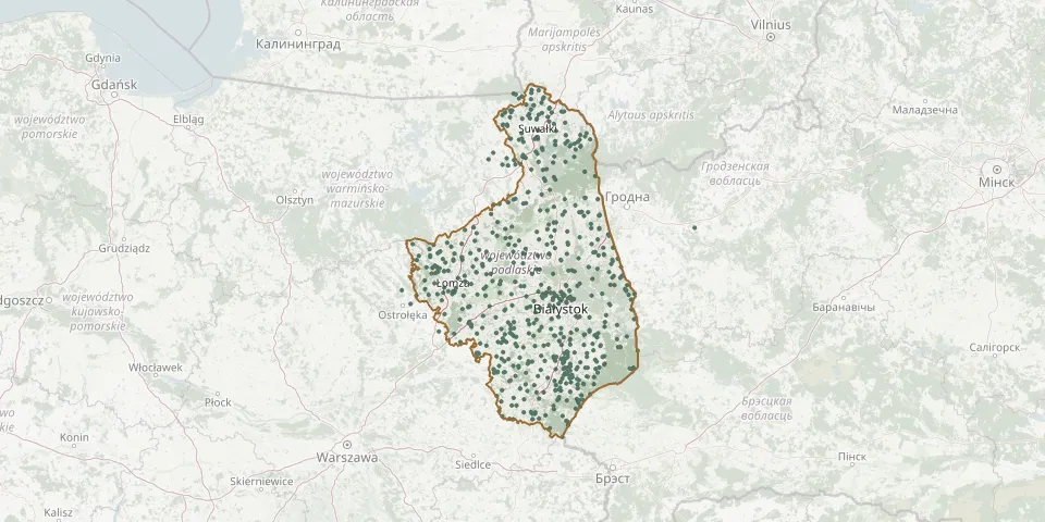 © OpenStreetMap
- Słucz Parish CemeteryGPS coordinates: 53.42373° N, 22.33614° E
- Smolany Parish CemeteryGPS coordinates: 54.18461° N, 23.20243° E
- Smolniki Roman Catholic CemeteryGPS coordinates: 54.28739° N, 22.88458° E
- Śniadowo Parish CemeteryGPS coordinates: 53.03762° N, 21.98687° E
- Śnieżki Orthodox CemeteryGPS coordinates: 52.58768° N, 23.15220° E
- Sobiatyn Greek Catholic CemeteryGPS coordinates: 52.57134° N, 23.10601° E
- Sobiatyn Orthodox CemeteryGPS coordinates: 52.57128° N, 23.10619° E
- Sobolewo Orthodox CemeteryGPS coordinates: 53.12047° N, 23.26754° E
- Sokolany Parish CemeteryGPS coordinates: 53.46021° N, 23.47224° E
- Sokołda War Cemetery 1831GPS coordinates: 53.24973° N, 23.47686° E
- Sokółka Evangelical Cemetery (closed)GPS coordinates: 53.41249° N, 23.50572° E
- Sokółka Jewish CemeteryGPS coordinates: 53.40857° N, 23.48798° E
- Sokółka Orthodox CemeteryGPS coordinates: 53.41186° N, 23.50609° E
- Sokółka Parish CemeteryGPS coordinates: 53.39112° N, 23.54120° E
- Sokółka Red Army CemeteryGPS coordinates: 53.41277° N, 23.50546° E
- Sokolne Old Believers' Cemetery, Nowinka CommuneGPS coordinates: 53.95199° N, 22.93401° E
- Sokoły Parish CemeteryGPS coordinates: 52.98943° N, 22.68809° E
- Soliny Evangelical CemeteryGPS coordinates: 54.32270° N, 22.86020° E
- Spiczki Orthodox CemeteryGPS coordinates: 52.71781° N, 23.25695° E
- Spiczki Orthodox CemeteryGPS coordinates: 52.71592° N, 23.24366° E
- Średnica War Cemetery (World War I)GPS coordinates: 52.88843° N, 22.57425° E
- Średnica War Cemetery (World War I)GPS coordinates: 52.87491° N, 22.58734° E
- St. Andrew Bobola Roman Catholic Parish Cemetery, BiałystokGPS coordinates: 53.13380° N, 23.08273° E
- St. Anne Churchyard, KrynkiGPS coordinates: 53.25942° N, 23.76514° E
- Stara Grzybowszczyzna Orthodox CemeteryGPS coordinates: 53.21345° N, 23.69941° E
- Stare Wnory Parish CemeteryGPS coordinates: 53.05861° N, 22.59268° E
- Starokamienna Roman Catholic CemeteryGPS coordinates: 53.69180° N, 23.30610° E
- Starowlany Cholera CemeteryGPS coordinates: 53.48753° N, 23.53409° E
- Stary Kornin Orthodox CemeteryGPS coordinates: 52.71041° N, 23.42872° E
- Stary Skarżyn Parish CemeteryGPS coordinates: 52.91857° N, 22.31308° E