
Subcarpathian Voivodeship
1,346 known cemeteries in Subcarpathian Voivodeship, Poland.
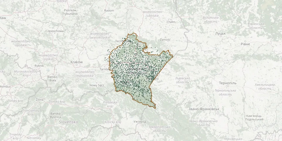 © OpenStreetMap
- Łańcut Soviet War CemeteryGPS coordinates: 50.06125° N, 22.22698° E
- Łapajówka First World War CemeteryGPS coordinates: 49.97303° N, 22.99943° E
- Laskówka CemeteryGPS coordinates: 49.85630° N, 22.28511° E
- Laszki Greek Catholic CemeteryGPS coordinates: 50.02748° N, 22.91695° E
- Łazy Greek Catholic CemeteryGPS coordinates: 49.99454° N, 22.86928° E
- Lecka Roman Catholic CemeteryGPS coordinates: 49.87816° N, 22.01002° E
- Łęki Dolne War Cemetery No. 239GPS coordinates: 49.97864° N, 21.21390° E
- Łęki Dukielskie CemeteryGPS coordinates: 49.60754° N, 21.66953° E
- Łęki Górne Parish CemeteryGPS coordinates: 49.97748° N, 21.21420° E
- Łęki Strzyżowskie Parish CemeteryGPS coordinates: 49.79982° N, 21.68107° E
- Lesko Jewish CemeteryGPS coordinates: 49.47019° N, 22.33283° E
- Lesko Municipal CemeteryGPS coordinates: 49.47571° N, 22.33232° E
- Lesko War Cemetery 1914-1915GPS coordinates: 49.47519° N, 22.33235° E
- Leśniówka Municipal CemeteryGPS coordinates: 49.64664° N, 21.64945° E
- Leszczawa Dolna Denominational Cemetery (now Roman Catholic)GPS coordinates: 49.66004° N, 22.43142° E
- Leszczowate CemeteryGPS coordinates: 49.50285° N, 22.55126° E
- Łętownia Denominational Cemetery (now Roman Catholic)GPS coordinates: 49.81006° N, 22.70270° E
- Leżachów Cholera CemeteryGPS coordinates: 50.14064° N, 22.62246° E
- Leżachów Greek Catholic Cemetery (now Roman Catholic)GPS coordinates: 50.14199° N, 22.61116° E
- Leżachów War Cemetery from World War IGPS coordinates: 50.13859° N, 22.60589° E
- Leżajsk CemeteryGPS coordinates: 50.27177° N, 22.40767° E
- Leżajsk Jewish CemeteryGPS coordinates: 50.25129° N, 22.42195° E
- Leżajsk Municipal CemeteryGPS coordinates: 50.25200° N, 22.41272° E
- Łężany Cholera CemeteryGPS coordinates: 49.65752° N, 21.80602° E
- Łężany Roman Catholic CemeteryGPS coordinates: 49.64252° N, 21.80846° E
- Łężyny Municipal CemeteryGPS coordinates: 49.64190° N, 21.51680° E
- Lipie ChurchyardGPS coordinates: 49.30094° N, 22.69849° E
- Lipiny Górne Historic Orthodox CemeteryGPS coordinates: 50.42182° N, 22.49623° E
- Lipnica Parish CemeteryGPS coordinates: 50.28604° N, 21.88521° E
- Lipowiec Former Village Greek Catholic CemeteryGPS coordinates: 49.40549° N, 21.77719° E