
Subcarpathian Voivodeship
1,346 known cemeteries in Subcarpathian Voivodeship, Poland.
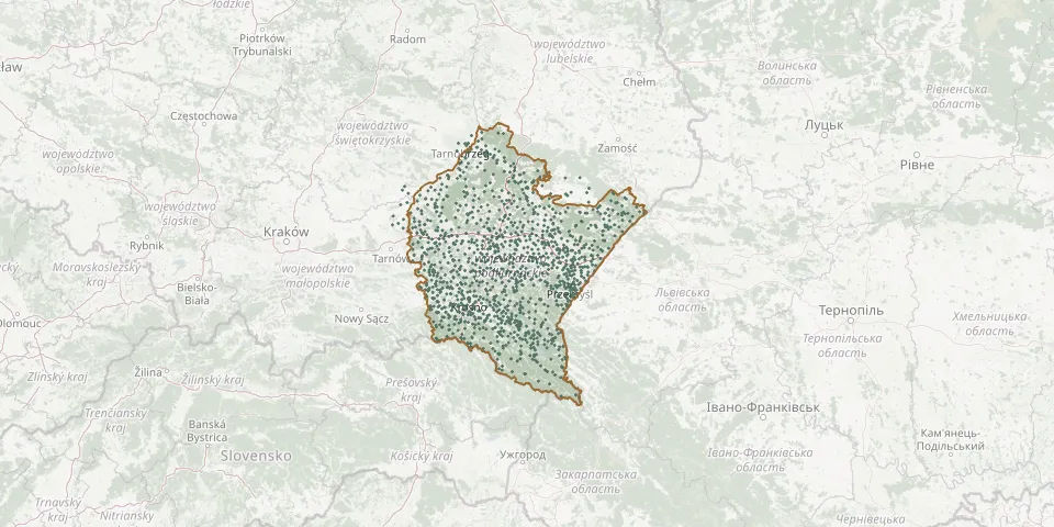 © OpenStreetMap
- Zatwarnica CemeteryGPS coordinates: 49.22204° N, 22.54764° E
- Zawadka Brzostecka War Cemetery No. 226GPS coordinates: 49.90070° N, 21.37930° E
- Zawadka Rymanowska Old Lemko CemeteryGPS coordinates: 49.50418° N, 21.72518° E
- Zborówek CemeteryGPS coordinates: 50.39389° N, 21.09568° E
- Zbydniów First World War CemeteryGPS coordinates: 50.63309° N, 21.91549° E
- Zbydniów War CemeteryGPS coordinates: 50.63197° N, 21.94346° E
- Żdżary Parish CemeteryGPS coordinates: 50.04862° N, 21.20191° E
- Zdziarzec Parish CemeteryGPS coordinates: 50.16871° N, 21.27134° E
- Żeglce Parish CemeteryGPS coordinates: 49.65520° N, 21.65681° E
- Zgłobień Roman Catholic CemeteryGPS coordinates: 50.01449° N, 21.85287° E
- Zgoda Parish CemeteryGPS coordinates: 50.00362° N, 22.75261° E
- Ziempniów Parish CemeteryGPS coordinates: 50.32503° N, 21.24890° E
- Zmiennica Roman Catholic CemeteryGPS coordinates: 49.67575° N, 21.97068° E
- Zmysłówka CemeteryGPS coordinates: 49.59979° N, 21.90530° E
- Zniszczony Jewish CemeteryGPS coordinates: 49.92244° N, 22.51541° E
- Żołynia Jewish CemeteryGPS coordinates: 50.15817° N, 22.30176° E
- Zręcin New Roman Catholic CemeteryGPS coordinates: 49.66681° N, 21.68719° E
- Zubeńsko War Cemetery (World War I)GPS coordinates: 49.23166° N, 22.09339° E
- Żuków Historic Greek Catholic Cemetery, 19th/20th CenturyGPS coordinates: 50.27375° N, 23.15704° E
- Żurawica Górna Municipal CemeteryGPS coordinates: 49.82412° N, 22.75801° E
- Żurawiczki Roman Catholic CemeteryGPS coordinates: 50.02343° N, 22.51290° E
- Zwięczyca Municipal CemeteryGPS coordinates: 50.01879° N, 21.97468° E
- Zwiernik Roman Catholic CemeteryGPS coordinates: 49.94165° N, 21.20140° E
- Zyndranowa Denominational CemeteryGPS coordinates: 49.43701° N, 21.71621° E
- Żyraków Parish CemeteryGPS coordinates: 50.08141° N, 21.39273° E
- Żyznów Parish CemeteryGPS coordinates: 49.81313° N, 21.84045° E