
Subcarpathian Voivodeship
1,346 known cemeteries in Subcarpathian Voivodeship, Poland.
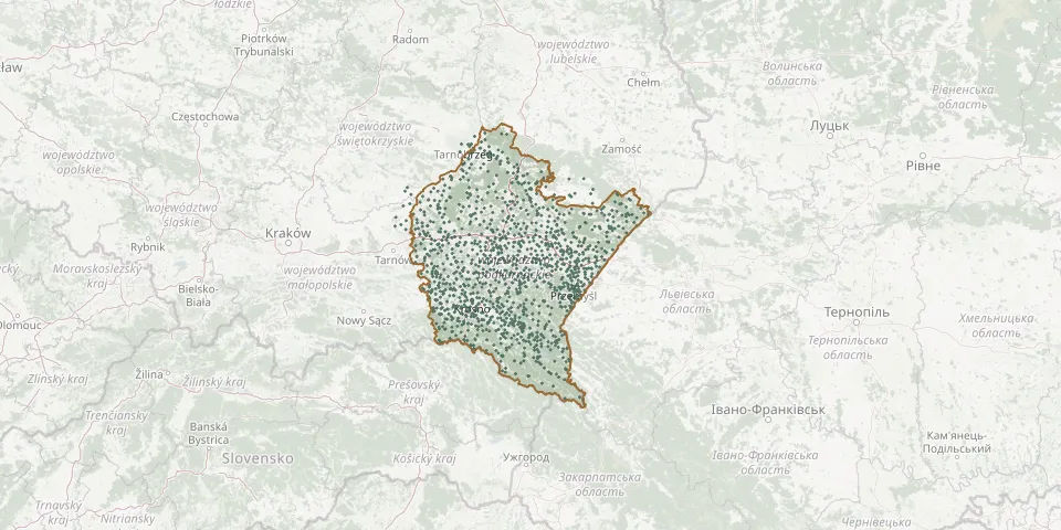 © OpenStreetMap
- Wolica Parish CemeteryGPS coordinates: 49.50632° N, 22.09115° E
- Wólka Małkowa World War I CemeteryGPS coordinates: 50.13294° N, 22.54320° E
- Wólka Parish CemeteryGPS coordinates: 49.97087° N, 22.06889° E
- Wólka Pełkińska Roman Catholic CemeteryGPS coordinates: 50.09167° N, 22.60194° E
- Wólka Podleśna Parish CemeteryGPS coordinates: 50.12640° N, 22.12229° E
- Wólka War Cemetery (World Wars I and II)GPS coordinates: 50.45533° N, 22.41132° E
- Wołkowyja Greek Catholic CemeteryGPS coordinates: 49.33295° N, 22.41548° E
- Wołkowyja Parish CemeteryGPS coordinates: 49.32220° N, 22.41476° E
- Wołodz Greek Catholic CemeteryGPS coordinates: 49.73929° N, 22.21784° E
- Wołosate Old Cemetery and Former Church SiteGPS coordinates: 49.06240° N, 22.68774° E
- Wróblik Królewski CemeteryGPS coordinates: 49.61762° N, 21.85459° E
- Wróblik Szlachecki CemeteryGPS coordinates: 49.61696° N, 21.87265° E
- Wrocanka Parish CemeteryGPS coordinates: 49.63186° N, 21.73918° E
- Wrzawy Parish CemeteryGPS coordinates: 50.70652° N, 21.85702° E
- Wybrzeże Greek Catholic CemeteryGPS coordinates: 49.81858° N, 22.38429° E
- Wydrna Parish CemeteryGPS coordinates: 49.71898° N, 22.13386° E
- Wydrza World War I CemeteryGPS coordinates: 50.54190° N, 21.84809° E
- Wygnanka CemeteryGPS coordinates: 49.39410° N, 22.13282° E
- Wysocko Greek Catholic Cemetery (now Roman Catholic)GPS coordinates: 49.99176° N, 22.82830° E
- Wysoka Głogowska Roman Catholic CemeteryGPS coordinates: 50.15142° N, 22.01536° E
- Wysoka Roman Catholic CemeteryGPS coordinates: 50.04738° N, 22.24712° E
- Wysoka Strzyżowska Roman Catholic CemeteryGPS coordinates: 49.83340° N, 21.73665° E
- Wysokoniwka Parish CemeteryGPS coordinates: 50.34085° N, 21.86152° E
- Wyszatyce Parish CemeteryGPS coordinates: 49.84184° N, 22.88994° E
- Wzdów Roman Catholic CemeteryGPS coordinates: 49.63982° N, 22.00283° E
- Zabłotce Municipal Cemetery (southern part)GPS coordinates: 49.90535° N, 22.78262° E
- Zaborów Parish CemeteryGPS coordinates: 49.91555° N, 21.83036° E
- Zabratówka Roman Catholic CemeteryGPS coordinates: 49.95369° N, 22.21001° E
- Zaczernie Roman Catholic CemeteryGPS coordinates: 50.09172° N, 21.99420° E
- Zadąbrowie Greek Catholic Cemetery (now Roman Catholic)GPS coordinates: 49.90200° N, 22.82111° E