
Subcarpathian Voivodeship
1,346 known cemeteries in Subcarpathian Voivodeship, Poland.
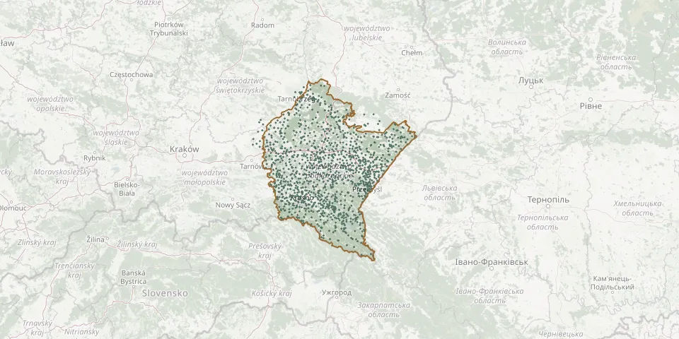 © OpenStreetMap
- Ułazów Parish CemeteryGPS coordinates: 50.27034° N, 23.00430° E
- Urzejowice Roman Catholic CemeteryGPS coordinates: 50.01471° N, 22.45682° E
- Ustjanowa Dolna Parish CemeteryGPS coordinates: 49.43120° N, 22.52100° E
- Ustjanowa Górna Parish CemeteryGPS coordinates: 49.41941° N, 22.55396° E
- Ustrobna Roman Catholic CemeteryGPS coordinates: 49.74924° N, 21.69466° E
- Ustrzyki Dolne CemeteryGPS coordinates: 49.43271° N, 22.59184° E
- Ustrzyki Dolne Jewish CemeteryGPS coordinates: 49.42734° N, 22.58798° E
- Visitation Sisters' Cemetery, JasłoGPS coordinates: 49.73584° N, 21.47533° E
- Wacławice Parish CemeteryGPS coordinates: 49.88675° N, 22.74927° E
- Wadowice Dolne Parish CemeteryGPS coordinates: 50.27516° N, 21.25201° E
- Wadowice Górne Cholera CemeteryGPS coordinates: 50.26060° N, 21.28756° E
- Walawa CemeteryGPS coordinates: 49.86510° N, 22.88953° E
- Wańkowa Parish CemeteryGPS coordinates: 49.51423° N, 22.48707° E
- Wapowce Denominational Cemetery (now Roman Catholic)GPS coordinates: 49.80793° N, 22.67178° E
- Wara Parish CemeteryGPS coordinates: 49.75383° N, 22.20983° E
- Warzyce War Cemetery No. 21GPS coordinates: 49.76942° N, 21.54352° E
- Węgierka Greek Catholic Cemetery (now Roman Catholic)GPS coordinates: 49.88517° N, 22.55764° E
- Węgliska CemeteryGPS coordinates: 50.16697° N, 22.20378° E
- Węglówka Greek Catholic Cemetery (now Roman Catholic)GPS coordinates: 49.77914° N, 21.77534° E
- Werchrata War CemeteryGPS coordinates: 50.25769° N, 23.46983° E
- Wesoła Old Parish CemeteryGPS coordinates: 49.80232° N, 22.09812° E
- Wiązownica Roman Catholic CemeteryGPS coordinates: 50.08639° N, 22.69070° E
- Widełka Parish CemeteryGPS coordinates: 50.20228° N, 21.88206° E
- Wielkie Oczy Jewish CemeteryGPS coordinates: 50.02112° N, 23.16421° E
- Wielopole Parish CemeteryGPS coordinates: 49.49532° N, 22.26662° E
- Wielopole Skrzyńskie Cemetery 1GPS coordinates: 49.94341° N, 21.60851° E
- Wielopole Skrzyńskie Cemetery No. 2GPS coordinates: 49.94241° N, 21.60611° E
- Wielopole Skrzyńskie Jewish CemeteryGPS coordinates: 49.94480° N, 21.61883° E
- Wielopol Skrzyński Cemetery, RzegocinGPS coordinates: 49.94953° N, 21.60407° E
- Wierzbna Roman Catholic CemeteryGPS coordinates: 50.03334° N, 22.60501° E