
Subcarpathian Voivodeship
1,346 known cemeteries in Subcarpathian Voivodeship, Poland.
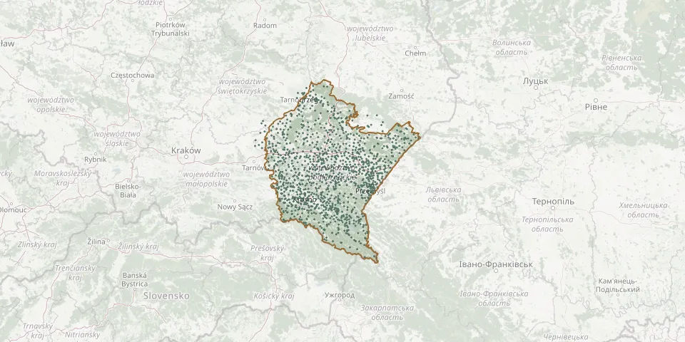 © OpenStreetMap
- Młodów Parish CemeteryGPS coordinates: 50.15781° N, 23.17959° E
- Młyny Greek Catholic Cemetery (now Roman Catholic)GPS coordinates: 49.97650° N, 23.05184° E
- Moczary Parish CemeteryGPS coordinates: 49.38454° N, 22.67253° E
- Mokre CemeteryGPS coordinates: 49.45392° N, 22.15716° E
- Mołodycz CemeteryGPS coordinates: 50.16190° N, 22.82912° E
- Mołodycz Greek Catholic CemeteryGPS coordinates: 50.16471° N, 22.83154° E
- Mołodycz War CemeteryGPS coordinates: 50.16420° N, 22.83414° E
- Mołodycz World War I CemeteryGPS coordinates: 50.16942° N, 22.83539° E
- Monastyr CemeteryGPS coordinates: 50.28720° N, 23.44219° E
- Morawsko Roman Catholic CemeteryGPS coordinates: 49.96427° N, 22.69963° E
- Morochów CemeteryGPS coordinates: 49.46958° N, 22.18280° E
- Mrowla Parish CemeteryGPS coordinates: 50.09774° N, 21.91808° E
- Mrzygłód CemeteryGPS coordinates: 49.62237° N, 22.27112° E
- Mrzygłód Old CemeteryGPS coordinates: 49.62281° N, 22.27329° E
- Mszana Greek Catholic Cemetery (now Roman Catholic)GPS coordinates: 49.49136° N, 21.65409° E
- Munina Roman Catholic CemeteryGPS coordinates: 49.99597° N, 22.72703° E
- Myczkowce CemeteryGPS coordinates: 49.43544° N, 22.41285° E
- Myczków Denominational Cemetery (now Roman Catholic)GPS coordinates: 49.37955° N, 22.41382° E
- Mymoń CemeteryGPS coordinates: 49.57055° N, 21.94188° E
- Mymoń World War I CemeteryGPS coordinates: 49.56920° N, 21.94210° E
- Myscowa Parish CemeteryGPS coordinates: 49.52595° N, 21.56131° E
- Nadżyt CemeteryGPS coordinates: 49.78710° N, 22.29628° E
- Nagawczyna Parish CemeteryGPS coordinates: 50.04931° N, 21.47002° E
- Nakło Roman Catholic CemeteryGPS coordinates: 49.86917° N, 22.95889° E
- Nakło War Cemetery (World War I)GPS coordinates: 49.86886° N, 22.95895° E
- Nawsie Górne Parish CemeteryGPS coordinates: 49.94498° N, 21.66624° E
- Nehrybka Greek Catholic Cemetery (now Roman Catholic)GPS coordinates: 49.75243° N, 22.80020° E
- Nehrybka Soviet and Italian Prisoner-of-War Cemetery 1941-1944GPS coordinates: 49.75539° N, 22.80684° E
- Niechobrz Parish CemeteryGPS coordinates: 49.99123° N, 21.88087° E
- Nieczajna Parish CemeteryGPS coordinates: 50.18226° N, 21.05625° E