
Subcarpathian Voivodeship
1,346 known cemeteries in Subcarpathian Voivodeship, Poland.
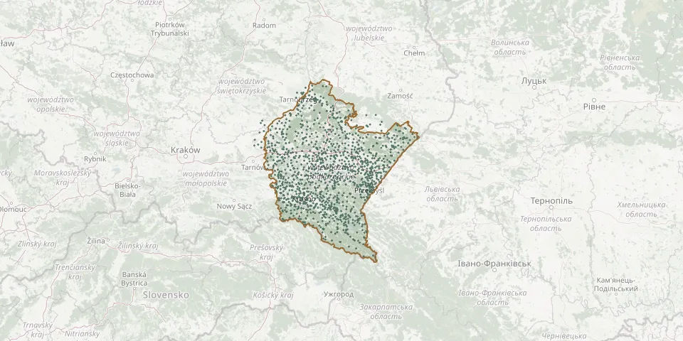 © OpenStreetMap
- Bykowce Old CemeteryGPS coordinates: 49.54625° N, 22.27781° E
- Bystre CemeteryGPS coordinates: 49.31588° N, 22.72346° E
- Bystre CemeteryGPS coordinates: 49.30552° N, 22.27619° E
- Bystre Parish CemeteryGPS coordinates: 50.37809° N, 22.40512° E
- Bystrzyca Roman Catholic CemeteryGPS coordinates: 49.98444° N, 21.72222° E
- Catholic CemeteryGPS coordinates: 50.30976° N, 21.63584° E
- Cerkwisko BukowiecGPS coordinates: 49.07032° N, 22.83375° E
- Cerkwisko First World War CemeteryGPS coordinates: 49.24173° N, 22.06575° E
- Cetula Greek Catholic Cemetery (now Roman Catholic)GPS coordinates: 50.09666° N, 22.79946° E
- Cetula World War I CemeteryGPS coordinates: 50.10513° N, 22.77832° E
- Cewków Old CemeteryGPS coordinates: 50.25119° N, 22.87847° E
- Cewków Parish CemeteryGPS coordinates: 50.25424° N, 22.87020° E
- Chałupki Dębniańskie Parish CemeteryGPS coordinates: 50.16751° N, 22.51468° E
- Chałupki Dusowskie Greek Catholic CemeteryGPS coordinates: 49.87749° N, 22.88998° E
- Chłopice Roman Catholic CemeteryGPS coordinates: 49.96037° N, 22.66483° E
- Chmiel CemeteryGPS coordinates: 49.22048° N, 22.60138° E
- Chmielnik Parish CemeteryGPS coordinates: 49.98143° N, 22.12306° E
- Chmielów Parish CemeteryGPS coordinates: 50.52232° N, 21.67603° E
- Chodaczów Roman Catholic CemeteryGPS coordinates: 50.13248° N, 22.50485° E
- Choleryczny CemeteryGPS coordinates: 49.56329° N, 21.82803° E
- Cholewiana Góra Parish CemeteryGPS coordinates: 50.35111° N, 22.06775° E
- Chołowice Greek Catholic ChurchyardGPS coordinates: 49.76381° N, 22.58244° E
- Chorzelów Parish CemeteryGPS coordinates: 50.33197° N, 21.44312° E
- Chotowa Parish CemeteryGPS coordinates: 50.02715° N, 21.29570° E
- Chotyniec ChurchyardGPS coordinates: 49.95297° N, 23.00414° E
- Chwałowice CemeteryGPS coordinates: 50.76203° N, 21.89347° E
- Chyrowa Parish CemeteryGPS coordinates: 49.52936° N, 21.61610° E
- Chyrzyna Greek Catholic CemeteryGPS coordinates: 49.78080° N, 22.54301° E
- Cieklin First World War CemeteryGPS coordinates: 49.64615° N, 21.36930° E
- Cieklin Parish CemeteryGPS coordinates: 49.64535° N, 21.38242° E