
Guarda District
220 known cemeteries in Guarda District, Portugal.
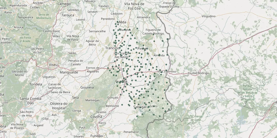 © OpenStreetMap
- Baraçal CemeteryGPS coordinates: 40.68306° N, 7.32862° W
- Barreira CemeteryGPS coordinates: 40.91238° N, 7.18871° W
- Batocas CemeteryGPS coordinates: 40.47410° N, 6.85461° W
- Bendada CemeteryGPS coordinates: 40.36696° N, 7.25943° W
- Benespera CemeteryGPS coordinates: 40.44046° N, 7.27266° W
- Bismula CemeteryGPS coordinates: 40.44403° N, 6.96330° W
- Bogalhal CemeteryGPS coordinates: 40.82023° N, 7.11865° W
- Cabreira CemeteryGPS coordinates: 40.56998° N, 7.03191° W
- Cardeal CemeteryGPS coordinates: 40.36895° N, 7.03233° W
- Carigas CemeteryGPS coordinates: 40.79540° N, 7.27363° W
- Carnicães CemeteryGPS coordinates: 40.73068° N, 7.31796° W
- Carvalhal CemeteryGPS coordinates: 40.88257° N, 7.28318° W
- Carvalhal Cemetery near Sul de PinhelGPS coordinates: 40.64474° N, 7.18109° W
- Carvalhal de Atalaia Cemetery (Pinhel)GPS coordinates: 40.69423° N, 7.01963° W
- Carvalhal Meão CemeteryGPS coordinates: 40.44546° N, 7.12542° W
- Casal de Cinza CemeteryGPS coordinates: 40.54357° N, 7.16506° W
- Casas de Moreira CemeteryGPS coordinates: 40.81783° N, 7.31795° W
- Castanheira CemeteryGPS coordinates: 40.57129° N, 7.08355° W
- Casteição CemeteryGPS coordinates: 40.87865° N, 7.32997° W
- Castelo Bom New CemeteryGPS coordinates: 40.61892° N, 6.89633° W
- Castelo Bom Old CemeteryGPS coordinates: 40.61943° N, 6.89866° W
- Castelo Mendo CemeteryGPS coordinates: 40.59452° N, 6.94883° W
- Castelo Rodrigo CemeteryGPS coordinates: 40.87644° N, 6.96208° W
- Celorico da Beira CemeteryGPS coordinates: 40.63393° N, 7.39395° W
- Cemtério de RendoGPS coordinates: 40.37906° N, 7.04375° W
- Cerejo CemeteryGPS coordinates: 40.73154° N, 7.22060° W
- Chãos CemeteryGPS coordinates: 40.89029° N, 7.32419° W
- Cheiras CemeteryGPS coordinates: 40.62490° N, 7.08990° W
- Cidadelhe CemeteryGPS coordinates: 40.91971° N, 7.11476° W
- Codesseiro CemeteryGPS coordinates: 40.65178° N, 7.20556° W