
Guarda District
220 known cemeteries in Guarda District, Portugal.
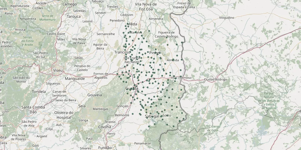 © OpenStreetMap
- Cogula CemeteryGPS coordinates: 40.81368° N, 7.25762° W
- Coriscada CemeteryGPS coordinates: 40.86758° N, 7.20639° W
- Cótimos CemeteryGPS coordinates: 40.82508° N, 7.23650° W
- Ervas Tenras CemeteryGPS coordinates: 40.74063° N, 7.18373° W
- Ervedosa CemeteryGPS coordinates: 40.84561° N, 7.17621° W
- Escarigo CemeteryGPS coordinates: 40.84347° N, 6.82828° W
- Esperança CemeteryGPS coordinates: 40.62747° N, 7.34195° W
- Espinhal CemeteryGPS coordinates: 40.37719° N, 7.13968° W
- Feital CemeteryGPS coordinates: 40.74949° N, 7.27949° W
- Foios CemeteryGPS coordinates: 40.28348° N, 6.90011° W
- Forcalhos CemeteryGPS coordinates: 40.37334° N, 6.82699° W
- Freineda CemeteryGPS coordinates: 40.58570° N, 6.88870° W
- Freixedas CemeteryGPS coordinates: 40.69227° N, 7.16556° W
- Freixial CemeteryGPS coordinates: 40.80121° N, 7.24207° W
- Freixinho CemeteryGPS coordinates: 40.67666° N, 7.09546° W
- Freixo CemeteryGPS coordinates: 40.62161° N, 7.00135° W
- Gagos CemeteryGPS coordinates: 40.58664° N, 7.11588° W
- Gamelas CemeteryGPS coordinates: 40.74190° N, 7.01636° W
- Gata CemeteryGPS coordinates: 40.52022° N, 7.21435° W
- Gateira CemeteryGPS coordinates: 40.88830° N, 7.17928° W
- Golfar CemeteryGPS coordinates: 40.81754° N, 7.33433° W
- Gonçalo Bocas CemeteryGPS coordinates: 40.57895° N, 7.17197° W
- Granja CemeteryGPS coordinates: 40.74692° N, 7.20073° W
- Granja CemeteryGPS coordinates: 40.59757° N, 7.10938° W
- Guarda CemeteryGPS coordinates: 40.53041° N, 7.25290° W
- Guarda New CemeteryGPS coordinates: 40.52725° N, 7.28035° W
- Guarda Old Municipal CemeteryGPS coordinates: 40.53611° N, 7.27191° W
- Guilhafonso CemeteryGPS coordinates: 40.62704° N, 7.20163° W
- João Antão CemeteryGPS coordinates: 40.46209° N, 7.24299° W
- João Durão CemeteryGPS coordinates: 40.69618° N, 7.19305° W