
Aragon
777 known cemeteries in Aragon, Spain.
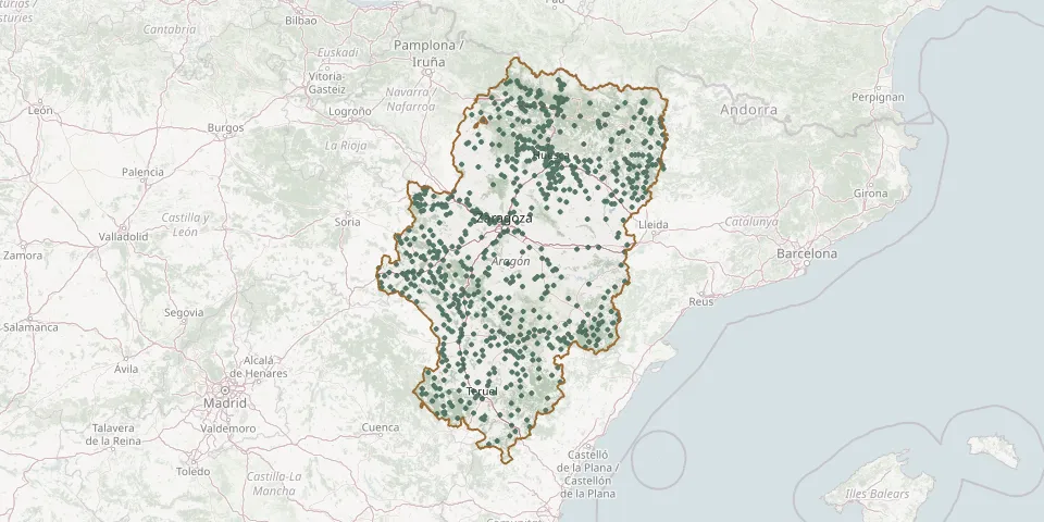 © OpenStreetMap
- Encinacorba Municipal CemeteryGPS coordinates: 41.29000° N, 1.26543° W
- Épila Municipal CemeteryGPS coordinates: 41.60428° N, 1.27589° W
- Erés CemeteryGPS coordinates: 42.25332° N, 0.75439° W
- Erla Municipal CemeteryGPS coordinates: 42.12178° N, 0.95060° W
- Escarrilla CemeteryGPS coordinates: 42.73456° N, 0.31174° W
- Escatrón Municipal CemeteryGPS coordinates: 41.28011° N, 0.30846° W
- Escorihuela CemeteryGPS coordinates: 40.55159° N, 0.98080° W
- Escucha Municipal CemeteryGPS coordinates: 40.79805° N, 0.81288° W
- Escuer CemeteryGPS coordinates: 42.59593° N, 0.33044° W
- Espés Alto CemeteryGPS coordinates: 42.44766° N, 0.58852° E
- Espés Parish CemeteryGPS coordinates: 42.43964° N, 0.58590° E
- Espierre CemeteryGPS coordinates: 42.59882° N, 0.29207° W
- Esposa CemeteryGPS coordinates: 42.65968° N, 0.62627° W
- Esquedas CemeteryGPS coordinates: 42.20904° N, 0.54905° W
- Estada CemeteryGPS coordinates: 42.07260° N, 0.23366° E
- Estadilla CemeteryGPS coordinates: 42.05872° N, 0.24892° E
- Estercuel CemeteryGPS coordinates: 40.85827° N, 0.63308° W
- Estopiñán del Castillo CemeteryGPS coordinates: 41.99858° N, 0.54418° E
- Fabara Municipal CemeteryGPS coordinates: 41.17025° N, 0.16432° E
- Fago CemeteryGPS coordinates: 42.73356° N, 0.86428° W
- Fanlo CemeteryGPS coordinates: 42.58704° N, 0.01979° W
- Fayón Municipal CemeteryGPS coordinates: 41.24728° N, 0.33426° E
- Fayón Old Cemetery (dismantled)GPS coordinates: 41.23566° N, 0.36134° E
- Ferreruela de Huerva CemeteryGPS coordinates: 41.05960° N, 1.22980° W
- Figueruelas Municipal CemeteryGPS coordinates: 41.76174° N, 1.17582° W
- Fiscal CemeteryGPS coordinates: 42.49093° N, 0.11664° W
- Fombuena CemeteryGPS coordinates: 41.14752° N, 1.19113° W
- Fonfría CemeteryGPS coordinates: 40.99348° N, 1.08340° W
- Fontellas CemeteryGPS coordinates: 42.24548° N, 0.68791° W
- Fonz Municipal CemeteryGPS coordinates: 42.00858° N, 0.25323° E