
Aragon
777 known cemeteries in Aragon, Spain.
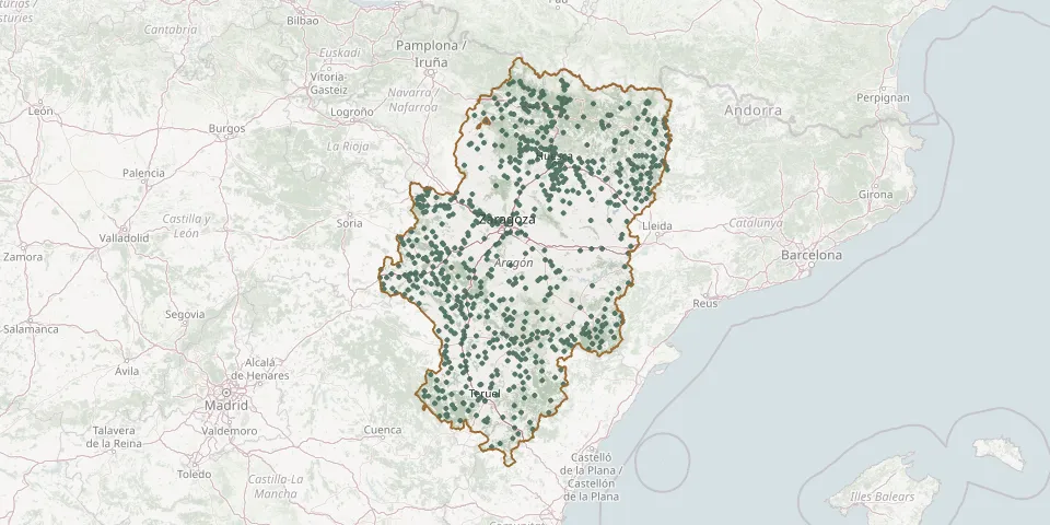 © OpenStreetMap
- Castillonroy CemeteryGPS coordinates: 41.88273° N, 0.51358° E
- Castilsabás CemeteryGPS coordinates: 42.19537° N, 0.30432° W
- Caudé CemeteryGPS coordinates: 40.41100° N, 1.19730° W
- Cedrillas CemeteryGPS coordinates: 40.43690° N, 0.86520° W
- Celadas Municipal CemeteryGPS coordinates: 40.47569° N, 1.15886° W
- Celadas Old CemeteryGPS coordinates: 40.47713° N, 1.14565° W
- Cella CemeteryGPS coordinates: 40.45972° N, 1.29778° W
- Cemeneterio municipalGPS coordinates: 41.33989° N, 1.21801° W
- Cemneterio ViejoGPS coordinates: 40.86597° N, 1.41580° W
- Cenarbe CemeteryGPS coordinates: 42.65493° N, 0.51556° W
- Cerler Municipal CemeteryGPS coordinates: 42.59449° N, 0.53825° E
- Cervera de la Cañada Municipal CemeteryGPS coordinates: 41.43208° N, 1.72620° W
- Cetina CemeteryGPS coordinates: 41.29205° N, 1.97181° W
- Chimillas CemeteryGPS coordinates: 42.16651° N, 0.45285° W
- Chistén Municipal CemeteryGPS coordinates: 42.59131° N, 0.33807° E
- Chodes CemeteryGPS coordinates: 41.48647° N, 1.47696° W
- Church of the Assumption Parish Cemetery, LitagoGPS coordinates: 41.81450° N, 1.75180° W
- Cimballa CemeteryGPS coordinates: 41.09244° N, 1.76706° W
- Cinco Olivas Municipal CemeteryGPS coordinates: 41.34239° N, 0.36936° W
- Cirujeda CemeteryGPS coordinates: 40.74091° N, 0.67471° W
- Ciscar CemeteryGPS coordinates: 42.07661° N, 0.54892° E
- Clarés de Ribota CemeteryGPS coordinates: 41.52715° N, 1.83713° W
- Cmenterio de CrivillénGPS coordinates: 40.88005° N, 0.57726° W
- Cobatillas CemeteryGPS coordinates: 40.66801° N, 0.74496° W
- Codos CemeteryGPS coordinates: 41.29642° N, 1.37743° W
- Collados CemeteryGPS coordinates: 40.99081° N, 1.16331° W
- Colungo CemeteryGPS coordinates: 42.17222° N, 0.07272° E
- Concud Municipal CemeteryGPS coordinates: 40.38128° N, 1.14655° W
- Contamina CemeteryGPS coordinates: 41.30857° N, 1.91321° W
- Corbalán Municipal CemeteryGPS coordinates: 40.39784° N, 0.98581° W