
Lucerne
62 known cemeteries in Lucerne, Switzerland.
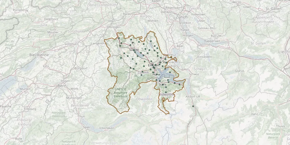 © OpenStreetMap
- Nottwil CemeteryGPS coordinates: 47.13221° N, 8.13873° E
- Schwarzenberg CemeteryGPS coordinates: 47.01600° N, 8.17423° E
- Ettiswil CemeteryGPS coordinates: 47.14996° N, 8.01755° E
- Hellbühl CemeteryGPS coordinates: 47.07025° N, 8.19695° E
- Werthenstein CemeteryGPS coordinates: 47.05391° N, 8.10366° E
- Eich CemeteryGPS coordinates: 47.15282° N, 8.16954° E
- Hildisrieden CemeteryGPS coordinates: 47.15067° N, 8.23021° E
- Udligenswil CemeteryGPS coordinates: 47.09160° N, 8.39990° E
- Hohenrain CemeteryGPS coordinates: 47.18172° N, 8.31753° E
- Buchrain CemeteryGPS coordinates: 47.09454° N, 8.34456° E
- Ballwil CemeteryGPS coordinates: 47.15213° N, 8.32060° E
- Büron CemeteryGPS coordinates: 47.21638° N, 8.09644° E
- Emmetten CemeteryGPS coordinates: 46.95680° N, 8.51940° E
- Kleinwangen CemeteryGPS coordinates: 47.19461° N, 8.29502° E
- Meierskappel CemeteryGPS coordinates: 47.12520° N, 8.44238° E
- Beromünster CemeteryGPS coordinates: 47.20688° N, 8.19394° E
- Buttisholz CemeteryGPS coordinates: 47.11499° N, 8.09455° E
- Büren Oberdorf NW CemeteryGPS coordinates: 46.94014° N, 8.39751° E
- Dagmersellen CemeteryGPS coordinates: 47.21306° N, 7.99194° E
- Erstfeld CemeteryGPS coordinates: 46.82137° N, 8.64389° E
- Grosswangen CemeteryGPS coordinates: 47.13292° N, 8.04962° E
- Hitzkirch CemeteryGPS coordinates: 47.22500° N, 8.25955° E
- Luzern-Friedental Jewish Cemetery (old)GPS coordinates: 47.06045° N, 8.28915° E
- Neudorf CemeteryGPS coordinates: 47.17645° N, 8.20995° E
- Reiden CemeteryGPS coordinates: 47.24380° N, 7.96972° E
- Rickenbach CemeteryGPS coordinates: 47.22002° N, 8.15226° E
- Römerswil CemeteryGPS coordinates: 47.16990° N, 8.24570° E
- Root CemeteryGPS coordinates: 47.11423° N, 8.39149° E
- Stämpfel CemeteryGPS coordinates: 47.19620° N, 7.98040° E
- Weggis CemeteryGPS coordinates: 47.03286° N, 8.43384° E