
Lucerne
62 known cemeteries in Lucerne, Switzerland.
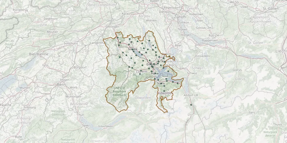 © OpenStreetMap
- Luzern Cemetery (Friedental)GPS coordinates: 47.06002° N, 8.29109° E
- Anderallmend CemeteryGPS coordinates: 47.03100° N, 8.28242° E
- Malters CemeteryGPS coordinates: 47.03612° N, 8.18339° E
- Stans CemeteryGPS coordinates: 46.95562° N, 8.36890° E
- Hochdorf CemeteryGPS coordinates: 47.16700° N, 8.29299° E
- Dägerstein CemeteryGPS coordinates: 47.16899° N, 8.10620° E
- Emmen-Gerliswil CemeteryGPS coordinates: 47.07752° N, 8.27317° E
- Ruswil CemeteryGPS coordinates: 47.08498° N, 8.12669° E
- Buochs CemeteryGPS coordinates: 46.97134° N, 8.42096° E
- Horw CemeteryGPS coordinates: 47.01941° N, 8.31371° E
- Wolhusen CemeteryGPS coordinates: 47.06036° N, 8.07522° E
- Bärtiswil-Rothenburg CemeteryGPS coordinates: 47.10059° N, 8.26220° E
- Littau-Luzern CemeteryGPS coordinates: 47.05048° N, 8.25698° E
- Meggen CemeteryGPS coordinates: 47.05415° N, 8.38975° E
- Eschenbach CemeteryGPS coordinates: 47.13371° N, 8.32192° E
- Sempach CemeteryGPS coordinates: 47.13718° N, 8.19205° E
- Kriens CemeteryGPS coordinates: 47.03237° N, 8.27891° E
- Neuenkirch CemeteryGPS coordinates: 47.09884° N, 8.20312° E
- Beckenried CemeteryGPS coordinates: 46.96611° N, 8.47570° E
- Ebikon CemeteryGPS coordinates: 47.08137° N, 8.33821° E
- Stansstad CemeteryGPS coordinates: 46.97862° N, 8.34181° E
- Hergiswil CemeteryGPS coordinates: 46.98455° N, 8.31034° E
- Triengen CemeteryGPS coordinates: 47.23500° N, 8.08000° E
- Emmen-Dorf CemeteryGPS coordinates: 47.07890° N, 8.30257° E
- Reussbühl CemeteryGPS coordinates: 47.06456° N, 8.28309° E
- Inwil CemeteryGPS coordinates: 47.12237° N, 8.35013° E
- Knutwil CemeteryGPS coordinates: 47.20114° N, 8.07302° E
- Ennetbürgen CemeteryGPS coordinates: 46.98489° N, 8.41463° E
- Oberkirch CemeteryGPS coordinates: 47.15766° N, 8.11620° E
- Adligenswil CemeteryGPS coordinates: 47.07026° N, 8.36579° E