
Solothurn
46 known cemeteries in Solothurn, Switzerland.
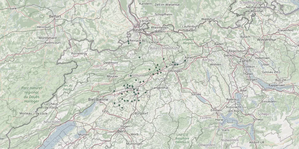 © OpenStreetMap
- Aeschi CemeteryGPS coordinates: 47.18198° N, 7.66090° E
- Aetingen CemeteryGPS coordinates: 47.13245° N, 7.50358° E
- Attiswil CemeteryGPS coordinates: 47.24526° N, 7.61577° E
- BalmkirchliGPS coordinates: 47.10580° N, 7.42980° E
- Balsthal CemeteryGPS coordinates: 47.32074° N, 7.69597° E
- Bätterkinden CemeteryGPS coordinates: 47.12842° N, 7.54036° E
- Bättwil CemeteryGPS coordinates: 47.49005° N, 7.50887° E
- Bellach CemeteryGPS coordinates: 47.21182° N, 7.50017° E
- Biberist CemeteryGPS coordinates: 47.18411° N, 7.55915° E
- Bibern CemeteryGPS coordinates: 47.14371° N, 7.45531° E
- Bleichenberg Cemetery, ZuchwilGPS coordinates: 47.20030° N, 7.55874° E
- Derendingen Municipal CemeteryGPS coordinates: 47.19630° N, 7.58755° E
- Dornach CemeteryGPS coordinates: 47.47994° N, 7.61475° E
- Dulliken CemeteryGPS coordinates: 47.35043° N, 7.94325° E
- Eptingen CemeteryGPS coordinates: 47.38410° N, 7.82074° E
- Feldbrunnen St. Niklaus CemeteryGPS coordinates: 47.22087° N, 7.54363° E
- Gerlafingen CemeteryGPS coordinates: 47.17220° N, 7.57487° E
- Grenchen CemeteryGPS coordinates: 47.19142° N, 7.38407° E
- Günsberg CemeteryGPS coordinates: 47.25676° N, 7.57698° E
- Hägendorf CemeteryGPS coordinates: 47.33798° N, 7.84583° E
- Hofstetten CemeteryGPS coordinates: 47.47772° N, 7.51195° E
- Holderbank CemeteryGPS coordinates: 47.33350° N, 7.75370° E
- Koppigen CemeteryGPS coordinates: 47.13481° N, 7.60058° E
- Kriegstetten CemeteryGPS coordinates: 47.17639° N, 7.59872° E
- Langenbruck CemeteryGPS coordinates: 47.34901° N, 7.76682° E
- Langendorf CemeteryGPS coordinates: 47.22230° N, 7.52130° E
- Leuzigen CemeteryGPS coordinates: 47.17434° N, 7.45284° E
- Lommiswil CemeteryGPS coordinates: 47.22410° N, 7.47280° E
- Meisenhard CemeteryGPS coordinates: 47.35001° N, 7.92152° E
- Messen SolothurnGPS coordinates: 47.09100° N, 7.45380° E