
Solothurn
46 known cemeteries in Solothurn, Switzerland.
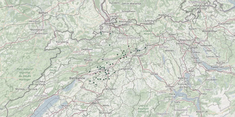 © OpenStreetMap
- Mühledorf CemeteryGPS coordinates: 47.13311° N, 7.47505° E
- Nenningkofen Cemetery, LüsslingenGPS coordinates: 47.18724° N, 7.49899° E
- Neuendorf CemeteryGPS coordinates: 47.30195° N, 7.79532° E
- Oberbuchsiten CemeteryGPS coordinates: 47.31291° N, 7.76701° E
- Oberdorf CemeteryGPS coordinates: 47.22900° N, 7.50220° E
- Oberkirch CemeteryGPS coordinates: 47.39362° N, 7.60703° E
- Oensingen CemeteryGPS coordinates: 47.29222° N, 7.72754° E
- Sandacker CemeteryGPS coordinates: 47.32054° N, 7.78458° E
- Schnottwil CemeteryGPS coordinates: 47.11710° N, 7.38630° E
- Schönenwerd CemeteryGPS coordinates: 47.37347° N, 8.00914° E
- St. Katharinen CemeteryGPS coordinates: 47.21758° N, 7.54690° E
- St. Nicholas Catholic Church Cemetery, NiederbuchsitenGPS coordinates: 47.29590° N, 7.76830° E
- Trimbach CemeteryGPS coordinates: 47.36367° N, 7.90205° E
- Utzenstorf CemeteryGPS coordinates: 47.13617° N, 7.56593° E
- Welschenrohr CemeteryGPS coordinates: 47.28260° N, 7.52980° E
- Wiedlisbach CemeteryGPS coordinates: 47.24905° N, 7.64160° E