
Kyiv Oblast
592 known cemeteries in Kyiv Oblast, Ukraine.
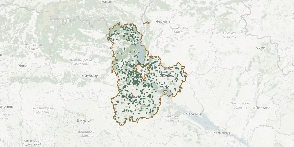 © OpenStreetMap
- Chepyliivka CemeteryGPS coordinates: 49.75971° N, 30.31401° E
- Cherevatske CemeteryGPS coordinates: 51.21630° N, 30.14166° E
- Cherkas CemeteryGPS coordinates: 49.69172° N, 30.21211° E
- Cherniakhiv CemeteryGPS coordinates: 50.01266° N, 30.79716° E
- Chervone CemeteryGPS coordinates: 50.35655° N, 31.95171° E
- Chervone Old CemeteryGPS coordinates: 50.35022° N, 31.95943° E
- Chmykhalivske CemeteryGPS coordinates: 50.40776° N, 31.91159° E
- Chopylky CemeteryGPS coordinates: 49.96865° N, 31.90107° E
- Chornohorodka CemeteryGPS coordinates: 50.21914° N, 29.96919° E
- Chystohalivske East CemeteryGPS coordinates: 51.35597° N, 30.04572° E
- Chystohalivske West CemeteryGPS coordinates: 51.36475° N, 30.00497° E
- Danylovskoe CemeteryGPS coordinates: 50.24766° N, 30.21985° E
- Denysovytske CemeteryGPS coordinates: 51.48499° N, 29.70294° E
- Dereviana Village CemeteryGPS coordinates: 50.11100° N, 30.68565° E
- Deshki CemeteryGPS coordinates: 49.52554° N, 30.94694° E
- Dibrovske East CemeteryGPS coordinates: 51.28222° N, 29.70713° E
- Dibrovske West CemeteryGPS coordinates: 51.27866° N, 29.67758° E
- Divoche CemeteryGPS coordinates: 49.82453° N, 30.10928° E
- Divychky CemeteryGPS coordinates: 50.08136° N, 31.27516° E
- Donbaske Cemetery, VasylkivGPS coordinates: 50.15913° N, 30.32439° E
- Doslidnytske CemeteryGPS coordinates: 49.92493° N, 30.16317° E
- Drozdy CemeteryGPS coordinates: 49.87836° N, 29.98040° E
- Druzhnya Village CemeteryGPS coordinates: 50.61978° N, 29.87371° E
- Dymer Jewish CemeteryGPS coordinates: 50.77950° N, 30.29075° E
- Dymer's cemeteryGPS coordinates: 50.78299° N, 30.29055° E
- Dytiatky CemeteryGPS coordinates: 51.11361° N, 30.15366° E
- Dzveniache CemeteryGPS coordinates: 49.38468° N, 29.57090° E
- Fasivochka Village CemeteryGPS coordinates: 50.44224° N, 29.78503° E
- Fastiv Jewish CemeteryGPS coordinates: 50.08915° N, 29.92843° E
- Fastiv Municipal CemeteryGPS coordinates: 50.09991° N, 29.95992° E