
Cornwall
350 known cemeteries in Cornwall, United Kingdom.
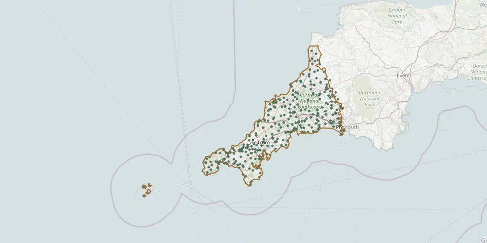 © OpenStreetMap
- Cemetery near LauncestonGPS coordinates: 50.66497° N, 4.53733° W
- Cemetery near LiftonGPS coordinates: 50.60998° N, 4.26956° W
- Cemetery near LooeGPS coordinates: 50.33580° N, 4.56965° W
- Cemetery near LooeGPS coordinates: 50.33791° N, 4.49054° W
- Cemetery near NewquayGPS coordinates: 50.41288° N, 5.00158° W
- Cemetery near Saint AustellGPS coordinates: 50.42600° N, 4.78006° W
- Cemetery near SaltashGPS coordinates: 50.48841° N, 4.25852° W
- Cemetery near TavistockGPS coordinates: 50.59084° N, 4.29587° W
- Cemetery near TavistockGPS coordinates: 50.56215° N, 4.24702° W
- Cemetery near TorpointGPS coordinates: 50.37315° N, 4.29342° W
- Cemetery near TorpointGPS coordinates: 50.32094° N, 4.21213° W
- Cemetery near TorpointGPS coordinates: 50.39314° N, 4.38174° W
- Centenary Methodist Chapel & CemeteryGPS coordinates: 50.21473° N, 5.29285° W
- Chacewater CemeteryGPS coordinates: 50.25418° N, 5.15606° W
- Connon Methodist ChapelGPS coordinates: 50.43706° N, 4.54148° W
- Connor Downs CemeteryGPS coordinates: 50.20958° N, 5.37006° W
- Crantock Street CemeteryGPS coordinates: 50.41305° N, 5.09181° W
- Crowan Anglican ChurchyardGPS coordinates: 50.16373° N, 5.29766° W
- Crowlas CemeteryGPS coordinates: 50.14976° N, 5.47661° W
- Crows-an-Wra Weslyan ChapelyardGPS coordinates: 50.09186° N, 5.64357° W
- Cubert CemeteryGPS coordinates: 50.38334° N, 5.11234° W
- Davidstow CemeteryGPS coordinates: 50.64873° N, 4.59962° W
- Delabole CemeteryGPS coordinates: 50.62024° N, 4.73180° W
- Dobwalls Methodist ChurchyardGPS coordinates: 50.45813° N, 4.51516° W
- Eastern Anglican CemeteryGPS coordinates: 50.18857° N, 5.43680° W
- Eden Methodist Chapel CemeteryGPS coordinates: 50.72007° N, 4.55915° W
- Edgcumbe Methodist Chapel GraveyardGPS coordinates: 50.15462° N, 5.19190° W
- Egloshayle CemeteryGPS coordinates: 50.51294° N, 4.81819° W
- Egloshayle ChurchyardGPS coordinates: 50.51259° N, 4.82084° W
- Fairpark CemeteryGPS coordinates: 50.41703° N, 5.03726° W