
Cornwall
350 known cemeteries in Cornwall, United Kingdom.
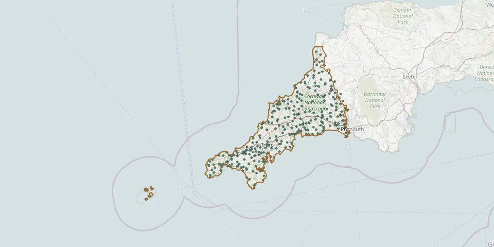 © OpenStreetMap
- Land's End CemeteryGPS coordinates: 50.12033° N, 5.67413° W
- Lanivet CemeteryGPS coordinates: 50.44529° N, 4.75943° W
- Lanlivery ChurchyardGPS coordinates: 50.39982° N, 4.70307° W
- Lanner ChristchurchGPS coordinates: 50.21410° N, 5.20475° W
- Lanreath CemeteryGPS coordinates: 50.38404° N, 4.55953° W
- Launcells CemeteryGPS coordinates: 50.83149° N, 4.46643° W
- Launceston CemeteryGPS coordinates: 50.64104° N, 4.36672° W
- Launceston CemeteryGPS coordinates: 50.66382° N, 4.36745° W
- Launceston CemeteryGPS coordinates: 50.63007° N, 4.37539° W
- Lawhitton CemeteryGPS coordinates: 50.61780° N, 4.32597° W
- Lesnewth (Saint Michael and All Saints) ChurchyardGPS coordinates: 50.68233° N, 4.64746° W
- Lewannick CemeteryGPS coordinates: 50.60062° N, 4.43774° W
- Lewannick CemeteryGPS coordinates: 50.59038° N, 4.44985° W
- Little Trethewey Wesleyan ChapelGPS coordinates: 50.05647° N, 5.66209° W
- Longstone CemeteryGPS coordinates: 50.19183° N, 5.46052° W
- Looe CemeteryGPS coordinates: 50.35596° N, 4.46091° W
- Luckett CemeteryGPS coordinates: 50.54292° N, 4.27575° W
- Mabe churchyardGPS coordinates: 50.14978° N, 5.14046° W
- Maker ChurchyardGPS coordinates: 50.34721° N, 4.18532° W
- Mawnan Community GraveyardGPS coordinates: 50.10398° N, 5.09424° W
- Mevagissey CemeteryGPS coordinates: 50.27422° N, 4.79201° W
- Mithian St PeterGPS coordinates: 50.28144° N, 5.16545° W
- Mount Hawke CemeteryGPS coordinates: 50.27933° N, 5.20785° W
- Mullion CemeteryGPS coordinates: 50.02911° N, 5.24251° W
- Mylor Parish CemeteryGPS coordinates: 50.17459° N, 5.05727° W
- Nanpean CemeteryGPS coordinates: 50.36834° N, 4.86471° W
- Nanstallon CemeteryGPS coordinates: 50.46982° N, 4.76522° W
- North Petherwin CemeteryGPS coordinates: 50.70747° N, 4.47930° W
- Padstow CemeteryGPS coordinates: 50.54100° N, 4.95321° W
- Parish of Week St. Mary ChurchyardGPS coordinates: 50.75189° N, 4.50025° W