
County Down
164 known cemeteries in County Down, United Kingdom.
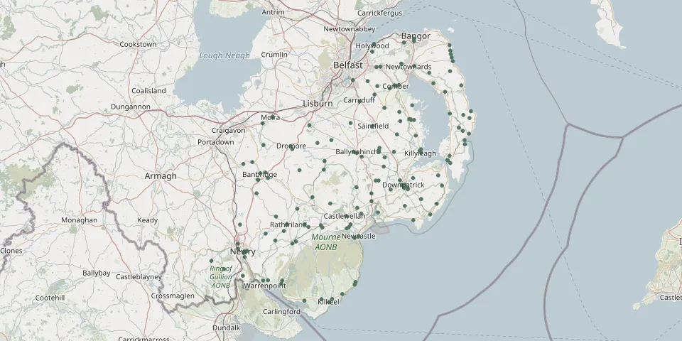 © OpenStreetMap
- Banbridge New CemeteryGPS coordinates: 54.33916° N, 6.27776° W
- Churchhill Cemetery and Christ Church, CarrowdoreGPS coordinates: 54.58303° N, 5.53590° W
- Down Cathedral New CemeteryGPS coordinates: 54.32699° N, 5.72272° W
- Kilkeel CemeteryGPS coordinates: 54.06258° N, 6.00286° W
- St Malachys Church, HillsboroughGPS coordinates: 54.46212° N, 6.08042° W
- Carryduff Presbyterian ChurchyardGPS coordinates: 54.51540° N, 5.88620° W
- Saintfield 2nd Presbyterian GraveyardGPS coordinates: 54.45870° N, 5.83700° W
- Slans Graveyard, CloghyGPS coordinates: 54.41879° N, 5.47827° W
- Templepatrick Graveyard DonaghadeeGPS coordinates: 54.62140° N, 5.53370° W
- 2nd & 3rd Rathfriland Presbyterian ChurchGPS coordinates: 54.23840° N, 6.16667° W
- Annalong Presbyterian ChurchyardGPS coordinates: 54.10828° N, 5.90119° W
- Aughlisnafin CemeteryGPS coordinates: 54.27607° N, 5.89492° W
- Ballee Church of Ireland ChurchyardGPS coordinates: 54.29572° N, 5.64828° W
- Ballyblack Presbyterian Church, NewtownardsGPS coordinates: 54.57966° N, 5.61711° W
- Ballycopeland Presbyterian GraveyardGPS coordinates: 54.61411° N, 5.53010° W
- Ballydown Presbyterian Church, BanbridgeGPS coordinates: 54.34304° N, 6.24002° W
- Ballyhalbert Church of Ireland GraveyardGPS coordinates: 54.47789° N, 5.46152° W
- Ballymacashen Reformed Presbyterian ChurchGPS coordinates: 54.47100° N, 5.72862° W
- Ballymanish Presbyterian CemeteryGPS coordinates: 54.39357° N, 5.53812° W
- Ballyphilip Church Of Ireland GraveyardGPS coordinates: 54.38293° N, 5.54560° W
- Banbridge First Presbyterian GraveyardGPS coordinates: 54.35390° N, 6.26925° W
- Banbridge Public CemeteryGPS coordinates: 54.33927° N, 6.27945° W
- Brookvale Presbyterian ChurchGPS coordinates: 54.25599° N, 6.20902° W
- Christ Church Ardkeen CemeteryGPS coordinates: 54.44934° N, 5.48677° W
- Christ Church BallyculterGPS coordinates: 54.34889° N, 5.58196° W
- Church of the Secred Heart LisleaGPS coordinates: 54.15586° N, 6.45935° W
- Clonallan CofI Parish Church WarrenpointGPS coordinates: 54.11206° N, 6.23985° W
- Clonduff Presbyterian ChurchGPS coordinates: 54.23857° N, 6.09961° W
- Cloughey Presbyterian Church CemeteryGPS coordinates: 54.42873° N, 5.48036° W
- Clough First Presbyterian Church GraveyardGPS coordinates: 54.29076° N, 5.84014° W