
County Down
164 known cemeteries in County Down, United Kingdom.
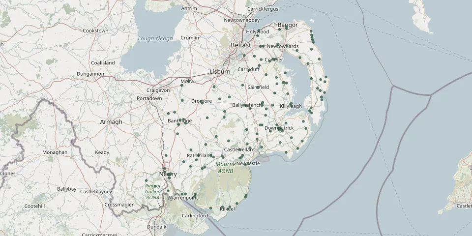 © OpenStreetMap
- Presbyterian Cemetery, MullaghglassGPS coordinates: 54.19496° N, 6.35654° W
- Presbyterian GraveyardGPS coordinates: 54.17613° N, 6.33173° W
- Rademon Non Subscribing Presbyterian ChurchGPS coordinates: 54.40584° N, 5.81082° W
- Rossglass GraveyardGPS coordinates: 54.24795° N, 5.67836° W
- Ryans Presbyterian GraveyardGPS coordinates: 54.21761° N, 6.24965° W
- Saint Colman's Church CemeteryGPS coordinates: 54.06883° N, 6.03373° W
- Saint John Church CemeteryGPS coordinates: 54.19977° N, 6.13208° W
- Saint John the Evangelist Church CemeteryGPS coordinates: 54.39957° N, 5.64834° W
- Saint Joseph’s Church GraveyardGPS coordinates: 54.45632° N, 5.50233° W
- Saint Malachy GraveyardGPS coordinates: 54.32605° N, 5.56716° W
- Saint Mary Parish Church Cemetery (Comber)GPS coordinates: 54.55022° N, 5.74380° W
- Saint Mary's Cabra Roman Catholic ChurchyardGPS coordinates: 54.23272° N, 6.08389° W
- Saint Michael the Archangel Church GraveyardGPS coordinates: 54.36192° N, 6.02429° W
- Saint Patrick’s Church CemeteryGPS coordinates: 54.23188° N, 5.92835° W
- Saul Roman Catholic ChurchyardGPS coordinates: 54.34332° N, 5.67923° W
- Seaforde Church of Ireland CemeteryGPS coordinates: 54.30833° N, 5.83998° W
- St. Clare's Convent CemeteryGPS coordinates: 54.17407° N, 6.33266° W
- St Colmans Church, NewcastleGPS coordinates: 54.20774° N, 5.90495° W
- St Dymphna's CemeteryGPS coordinates: 54.32071° N, 5.69991° W
- St James Church, PortaferryGPS coordinates: 54.38301° N, 5.54559° W
- St Johns Church, MoiraGPS coordinates: 54.48124° N, 6.22169° W
- St. John’s Church of Ireland DromaraGPS coordinates: 54.38152° N, 6.02125° W
- St John the Baptist CemeteryGPS coordinates: 54.32232° N, 5.89809° W
- St Macartan's Church CemeteryGPS coordinates: 54.33752° N, 5.82370° W
- St. Malachy's CemeteryGPS coordinates: 54.23162° N, 6.02987° W
- St. Mary Roman Catholic ChurchyardGPS coordinates: 54.21239° N, 5.88935° W
- St Mary's Barr CemeteryGPS coordinates: 54.23787° N, 6.34798° W
- St Mary's CemeteryGPS coordinates: 54.40759° N, 5.64866° W
- St Marys Chapel, ChapeltownGPS coordinates: 54.28485° N, 5.58770° W
- St. Mary's Roman Catholic Burial GroundGPS coordinates: 54.23716° N, 6.16795° W