
Lancashire
298 known cemeteries in Lancashire, United Kingdom.
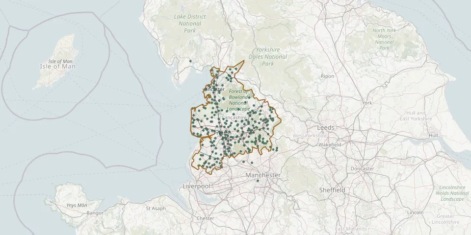 © OpenStreetMap
- St Oswald's Roman Catholic Church, CoppullGPS coordinates: 53.62188° N, 2.67114° W
- St Mary the Virgin ChurchyardGPS coordinates: 53.82665° N, 2.67070° W
- Clitheroe CemeteryGPS coordinates: 53.87780° N, 2.39733° W
- St. Michael's ChurchyardGPS coordinates: 53.56704° N, 2.76404° W
- Brindle St Josephs Church, HoghtonGPS coordinates: 53.73312° N, 2.60582° W
- West Bradford CemeteryGPS coordinates: 53.89535° N, 2.38937° W
- Inskip Baptist ChurchyardGPS coordinates: 53.83532° N, 2.82996° W
- Leyland (Saint Andrew) ChurchyardGPS coordinates: 53.68815° N, 2.69583° W
- St. Peter's ChurchyardGPS coordinates: 53.79245° N, 2.23949° W
- St. Peter ChurchyardGPS coordinates: 54.04742° N, 2.90193° W
- St Teresas RC Church Cemetery, Roby MillGPS coordinates: 53.55960° N, 2.73083° W
- St Francis Hill RC Churchyard, GoosnarghGPS coordinates: 53.84097° N, 2.65270° W
- St. Michael's ChurchyardGPS coordinates: 53.79907° N, 2.63525° W
- Bottomdale Cemetery, SlyneGPS coordinates: 54.08694° N, 2.79708° W
- St Luke Church, WinmarleighGPS coordinates: 53.92522° N, 2.80729° W
- Halton Burial GroundGPS coordinates: 54.07812° N, 2.77096° W
- Our Lady and St. Michael Roman Catholic ChurchyardGPS coordinates: 53.80880° N, 2.61335° W
- Scotforth CemeteryGPS coordinates: 54.02819° N, 2.80076° W
- St James Church, CalderbrookGPS coordinates: 53.66026° N, 2.09037° W
- St Catherine Church, West BradfordGPS coordinates: 53.89637° N, 2.39201° W
- Preston Old CemeteryGPS coordinates: 53.76864° N, 2.66232° W
- Haslingden cemeteryGPS coordinates: 53.70378° N, 2.32579° W
- Rawtenstall CemeteryGPS coordinates: 53.70640° N, 2.28350° W
- St. John the Evangelist ChurchyardGPS coordinates: 53.83670° N, 2.19772° W
- Croston CemeteryGPS coordinates: 53.65867° N, 2.77331° W
- Halsall Saint CuthbertGPS coordinates: 53.58546° N, 2.95227° W
- Kirkland Strict and Particular Baptist ChapelGPS coordinates: 53.89612° N, 2.81701° W
- St. Bartholomew ChurchyardGPS coordinates: 53.88468° N, 2.57641° W
- St Mary Church, Lea TownGPS coordinates: 53.77405° N, 2.79366° W
- Saltcotes Catholic CemeteryGPS coordinates: 53.74650° N, 2.94500° W