
North Lanarkshire
26 known cemeteries in North Lanarkshire, United Kingdom.
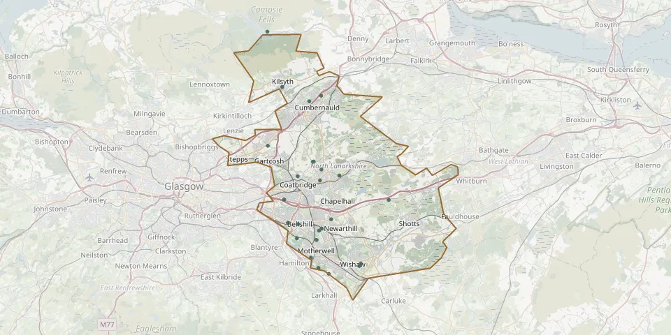 © OpenStreetMap
- Kilsyth CemeteryGPS coordinates: 55.97040° N, 4.05700° W
- Airbles Road CemeteryGPS coordinates: 55.78210° N, 4.00100° W
- Bothwell Park CemeteryGPS coordinates: 55.82061° N, 4.04635° W
- Coatbridge (Old Monkland) CemeteryGPS coordinates: 55.84638° N, 4.05341° W
- Moodiesburn (Bedlay) CemeteryGPS coordinates: 55.90564° N, 4.08567° W
- Eastfield Cemetery, CumbernauldGPS coordinates: 55.95464° N, 4.00427° W
- Airdrie(Saint Joseph) CemeteryGPS coordinates: 55.87935° N, 3.98008° W
- Holytown CemeteryGPS coordinates: 55.82436° N, 3.96091° W
- Cambusnethan CemeteryGPS coordinates: 55.77557° N, 3.90288° W
- Cumbernauld Village CemeteryGPS coordinates: 55.96070° N, 3.98050° W
- Globe CemeteryGPS coordinates: 55.80150° N, 3.98967° W
- Dalziel Old Manse Road Burial GroundGPS coordinates: 55.77074° N, 3.98612° W
- Bothwellhaugh CemeteryGPS coordinates: 55.80343° N, 4.02823° W
- Clarkston ChurchyardGPS coordinates: 55.87276° N, 3.94513° W
- Coltswood CemeteryGPS coordinates: 55.87201° N, 4.02705° W
- Dalziel CemeteryGPS coordinates: 55.80146° N, 3.99025° W
- Greenhead CemeteryGPS coordinates: 55.77270° N, 3.90560° W
- Kirk O'Muir CemeteryGPS coordinates: 56.03125° N, 4.08664° W
- New Monkland CemeteryGPS coordinates: 55.88794° N, 3.99726° W
- Old Monkland CemeteryGPS coordinates: 55.88820° N, 3.99540° W
- Saint Michaels CemeteryGPS coordinates: 55.76384° N, 3.96556° W
- Saint Patrick's CemeteryGPS coordinates: 55.81193° N, 3.98470° W
- South CemeteryGPS coordinates: 55.84585° N, 3.84807° W
- St Andrews United Free Church, BellshillGPS coordinates: 55.81903° N, 4.02587° W
- Wellwynd ChurchyardGPS coordinates: 55.86722° N, 3.98302° W
- Wrangholm ChurchyardGPS coordinates: 55.81410° N, 3.98002° W