
Scottish Borders
146 known cemeteries in Scottish Borders, United Kingdom.
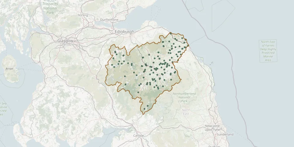 © OpenStreetMap
- Lindean ChurchGPS coordinates: 55.56830° N, 2.82070° W
- Linton CemeteryGPS coordinates: 55.52914° N, 2.36104° W
- Longformacus KirkGPS coordinates: 55.80781° N, 2.48964° W
- Longformacus New CemeteryGPS coordinates: 55.80387° N, 2.48672° W
- Longnewton KirkGPS coordinates: 55.53759° N, 2.67098° W
- Lyne ChurchyardGPS coordinates: 55.65149° N, 3.28579° W
- Manor ChurchyardGPS coordinates: 55.62919° N, 3.24001° W
- Maxton KirkGPS coordinates: 55.56541° N, 2.61960° W
- Mertoun CemeteryGPS coordinates: 55.58372° N, 2.61932° W
- Mertoun Old ChurchyardGPS coordinates: 55.57840° N, 2.59754° W
- Minto Parish ChurchyardGPS coordinates: 55.47293° N, 2.68708° W
- Mordington Old CemeteryGPS coordinates: 55.79162° N, 2.09007° W
- Mordington Old Parish ChurchGPS coordinates: 55.80960° N, 2.05210° W
- Morebattle ChurchGPS coordinates: 55.51805° N, 2.36238° W
- Nenthorn CemeteryGPS coordinates: 55.62433° N, 2.51248° W
- Nenthorn CemeteryGPS coordinates: 55.62732° N, 2.49932° W
- New Crailing CemeteryGPS coordinates: 55.51795° N, 2.50536° W
- Newlands CemeteryGPS coordinates: 55.72291° N, 3.33045° W
- Newton Don CemeteryGPS coordinates: 55.62438° N, 2.46970° W
- Old Aisle CemeteryGPS coordinates: 55.61191° N, 2.80297° W
- Old Parish Church and Burial-Ground, Kirk Wynd, SelkirkGPS coordinates: 55.54630° N, 2.84131° W
- Preston CemeteryGPS coordinates: 55.80612° N, 2.34153° W
- Renton House Burial GroundGPS coordinates: 55.87898° N, 2.27921° W
- Roberton KirkyardGPS coordinates: 55.42266° N, 2.89742° W
- Roxburgh CemeteryGPS coordinates: 55.57006° N, 2.47431° W
- Shawfield Cemetery, SelkirkGPS coordinates: 55.55354° N, 2.82760° W
- Shawpark CemeteryGPS coordinates: 55.55210° N, 2.83130° W
- Simprim Parish ChurchGPS coordinates: 55.70197° N, 2.23698° W
- Smailholm KirkGPS coordinates: 55.61998° N, 2.55901° W
- Southdean ChurchyardGPS coordinates: 55.38890° N, 2.59120° W