
Scottish Borders
146 known cemeteries in Scottish Borders, United Kingdom.
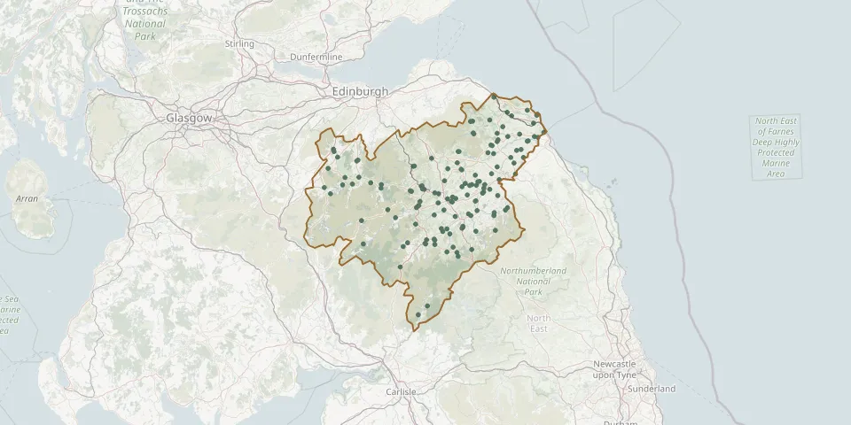 © OpenStreetMap
- Southdean KirkGPS coordinates: 55.37504° N, 2.58316° W
- Spittal-on-Rule GraveyardGPS coordinates: 55.47128° N, 2.65238° W
- St. Andrew's CemeteryGPS coordinates: 55.65294° N, 3.19879° W
- St. Andrew's ChurchyardGPS coordinates: 55.75076° N, 3.35625° W
- St Boswells ChurchGPS coordinates: 55.56774° N, 2.62637° W
- St Cuthbert's KirkyardGPS coordinates: 55.43201° N, 2.72792° W
- Stichill CemeteryGPS coordinates: 55.63870° N, 2.45137° W
- Stichill Old CemeteryGPS coordinates: 55.63722° N, 2.46020° W
- St John the Evangelist Church, JedburghGPS coordinates: 55.48129° N, 2.55398° W
- St Mary's and Old Parish ChurchyardGPS coordinates: 55.42043° N, 2.78857° W
- St. Mary's ChurchyardGPS coordinates: 55.50104° N, 3.18242° W
- St Michaels Church, GordonGPS coordinates: 55.68083° N, 2.56604° W
- Stobo Kirk GraveyardGPS coordinates: 55.62557° N, 3.29948° W
- Stow Cemetery NewGPS coordinates: 55.69215° N, 2.85457° W
- Stow Cemetery OldGPS coordinates: 55.69143° N, 2.86206° W
- Swinton CemeteryGPS coordinates: 55.72217° N, 2.25713° W
- Teviothead ChurchyardGPS coordinates: 55.33697° N, 2.94259° W
- Wellogate Cemetery, HawickGPS coordinates: 55.41895° N, 2.78493° W
- West Linton CemeteryGPS coordinates: 55.74281° N, 3.35287° W
- Westruther CemeteryGPS coordinates: 55.74305° N, 2.57804° W
- Westruther KirkGPS coordinates: 55.74251° N, 2.58411° W
- Whitsome CemeteryGPS coordinates: 55.74711° N, 2.22152° W
- Wilton CemeteryGPS coordinates: 55.43297° N, 2.77941° W
- Yarrow ChurchyardGPS coordinates: 55.53948° N, 3.01971° W
- Yetholm CemeteryGPS coordinates: 55.53755° N, 2.29056° W
- Yetholm Parish KirkyardGPS coordinates: 55.54630° N, 2.27769° W