
Shropshire
306 known cemeteries in Shropshire, United Kingdom.
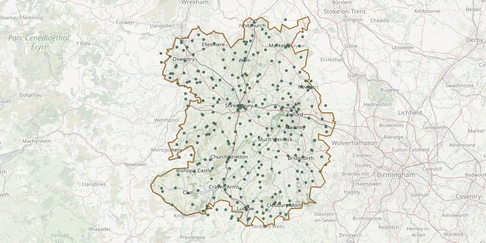 © OpenStreetMap
- Shelton and Oxon Christ Church ChurchyardGPS coordinates: 52.71398° N, 2.80201° W
- Longden Road Cemetery, ShrewsburyGPS coordinates: 52.69636° N, 2.75966° W
- Wellington CemeteryGPS coordinates: 52.69583° N, 2.52460° W
- St. Matthew's ChurchyardGPS coordinates: 52.71481° N, 2.43089° W
- St. Peter's ChurchyardGPS coordinates: 52.46406° N, 2.72497° W
- Telford (Saint George) ChurchyardGPS coordinates: 52.69526° N, 2.43206° W
- Hadley CemeteryGPS coordinates: 52.70971° N, 2.48937° W
- St Peter and St Paul, BridgnorthGPS coordinates: 52.54421° N, 2.44855° W
- Market Drayton CemeteryGPS coordinates: 52.90511° N, 2.49233° W
- Red Lake Garden of restGPS coordinates: 52.69290° N, 2.47159° W
- St. Peter's ChurchyardGPS coordinates: 52.52228° N, 2.71823° W
- Acton Scott (Saint Margaret) ChurchyardGPS coordinates: 52.50010° N, 2.80620° W
- Holy Trinity Church, Wrockwardine WoodGPS coordinates: 52.71097° N, 2.44708° W
- St. Mary the Virgin ChurchyardGPS coordinates: 52.69148° N, 2.47020° W
- St. Michael ChurchyardGPS coordinates: 52.71843° N, 2.87151° W
- Tilstock Christ ChurchyardGPS coordinates: 52.93626° N, 2.68188° W
- St. BartholomewsGPS coordinates: 52.66382° N, 2.30363° W
- St. John the Baptist ChurchyardGPS coordinates: 52.48983° N, 2.99840° W
- St Giles Church, ShrewsburyGPS coordinates: 52.70183° N, 2.73047° W
- St John the Baptist ChurchyardGPS coordinates: 52.43072° N, 2.83126° W
- St. Simon and St. Jude ChurchyardGPS coordinates: 52.85773° N, 2.84127° W
- Holy Trinity Church, LydhamGPS coordinates: 52.51326° N, 2.98027° W
- St Andrews Church, WroxeterGPS coordinates: 52.67012° N, 2.64735° W
- St John the Baptist, church yardGPS coordinates: 52.79358° N, 2.89894° W
- St. Mary's ChurchyardGPS coordinates: 52.90298° N, 2.48354° W
- St Michael & All Angels, Stanton LongGPS coordinates: 52.51260° N, 2.63273° W
- Whitchurch CemeteryGPS coordinates: 52.98030° N, 2.67335° W
- Dovaston URC ChurchGPS coordinates: 52.78397° N, 2.96646° W
- Hinstock (Saint Oswald) ChurchyardGPS coordinates: 52.83377° N, 2.45504° W
- St. Mary the Virgin ChurchyardGPS coordinates: 52.78634° N, 2.65509° W