
Lower Austria
1,114 known cemeteries in Lower Austria, Austria.
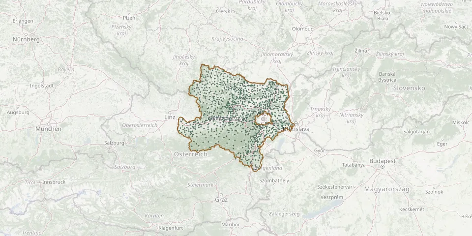 © OpenStreetMap
- Kottingneusiedl CemeteryGPS coordinates: 48.69758° N, 16.45796° E
- Kranichberg CemeteryGPS coordinates: 47.64558° N, 15.97753° E
- Krems an der Donau CemeteryGPS coordinates: 48.41575° N, 15.61781° E
- Krems Jewish CemeteryGPS coordinates: 48.41736° N, 15.62392° E
- Kritzendorf Cemetery (Saint Vitus)GPS coordinates: 48.32804° N, 16.30216° E
- Kronberg CemeteryGPS coordinates: 48.41867° N, 16.51329° E
- Krumau am Kamp Village CemeteryGPS coordinates: 48.59512° N, 15.44804° E
- Krumbach-Markt CemeteryGPS coordinates: 47.52085° N, 16.19835° E
- Krummnußbaum CemeteryGPS coordinates: 48.20596° N, 15.16254° E
- Krustetten CemeteryGPS coordinates: 48.36108° N, 15.65609° E
- Kühnring CemeteryGPS coordinates: 48.63338° N, 15.78346° E
- Laa an der Thaya CemeteryGPS coordinates: 48.73267° N, 16.40099° E
- Laab im Walde CemeteryGPS coordinates: 48.15155° N, 16.18172° E
- Lackenhof CemeteryGPS coordinates: 47.87001° N, 15.14737° E
- Ladendorf CemeteryGPS coordinates: 48.53809° N, 16.48611° E
- Ladendorf Urn GroveGPS coordinates: 48.54136° N, 16.48876° E
- Lahnsattel CemeteryGPS coordinates: 47.77187° N, 15.49878° E
- Laimbach CemeteryGPS coordinates: 48.31712° N, 15.12194° E
- Langau CemeteryGPS coordinates: 48.83137° N, 15.71468° E
- Langegg CemeteryGPS coordinates: 48.83204° N, 15.04492° E
- Langenlebarn CemeteryGPS coordinates: 48.32790° N, 16.11737° E
- Langenlois CemeteryGPS coordinates: 48.47128° N, 15.68049° E
- Langenlois Show CemeteryGPS coordinates: 48.46849° N, 15.67272° E
- Langschlag CemeteryGPS coordinates: 48.57380° N, 14.88337° E
- Langschwarza CemeteryGPS coordinates: 48.77604° N, 15.11177° E
- Lassee CemeteryGPS coordinates: 48.22564° N, 16.82173° E
- Lassing CemeteryGPS coordinates: 47.74484° N, 14.89713° E
- Laxenburg CemeteryGPS coordinates: 48.07375° N, 16.35863° E
- Lehen CemeteryGPS coordinates: 48.22751° N, 15.26479° E
- Leitzersdorf CemeteryGPS coordinates: 48.41677° N, 16.24183° E