
Flemish Brabant
352 known cemeteries in Flemish Brabant, Belgium.
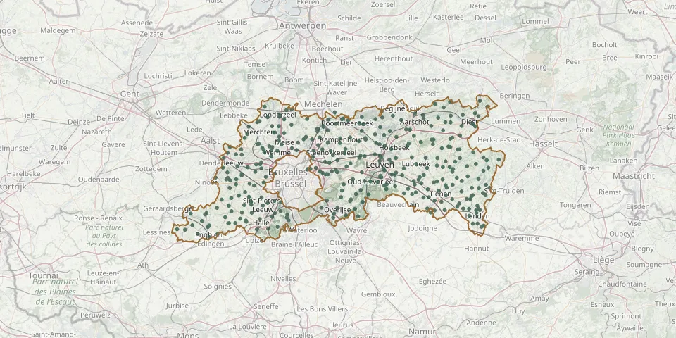 © OpenStreetMap
- Hoeilaart Communal CemeteryGPS coordinates: 50.77339° N, 4.47252° E
- Lot CemeteryGPS coordinates: 50.75966° N, 4.29059° E
- Sint-Genesius-Rode CemeteryGPS coordinates: 50.74198° N, 4.34430° E
- Enghien CemeteryGPS coordinates: 50.70070° N, 4.03450° E
- Machelen ChurchyardGPS coordinates: 50.91420° N, 4.44172° E
- Steenokkerzeel CemeteryGPS coordinates: 50.91325° N, 4.50838° E
- Bosdelle Cemetery, SterrebeekGPS coordinates: 50.86645° N, 4.52791° E
- Diegem ChurchyardGPS coordinates: 50.89841° N, 4.43894° E
- Wezembeek-Oppem Communal CemeteryGPS coordinates: 50.85585° N, 4.48828° E
- Herfelingen CemeteryGPS coordinates: 50.75003° N, 4.09660° E
- Baal CemeteryGPS coordinates: 50.99948° N, 4.75102° E
- Kester CemeteryGPS coordinates: 50.76463° N, 4.12216° E
- Blanden CemeteryGPS coordinates: 50.81940° N, 4.72520° E
- Bever CemeteryGPS coordinates: 50.71883° N, 3.94006° E
- Eizer CemeteryGPS coordinates: 50.79920° N, 4.54810° E
- Overijse Cemetery (Hagaard)GPS coordinates: 50.75854° N, 4.52128° E
- Sint-Agatha-Rode ChurchyardGPS coordinates: 50.78730° N, 4.63390° E
- Zuun CemeteryGPS coordinates: 50.78490° N, 4.26277° E
- Lovenjoel ChurchyardGPS coordinates: 50.85330° N, 4.78710° E
- Bertem ChurchyardGPS coordinates: 50.86104° N, 4.62954° E
- Duisburg CemeteryGPS coordinates: 50.81570° N, 4.55220° E
- Hoegaarden CemeteryGPS coordinates: 50.77140° N, 4.88540° E
- Korbeek-Lo ChurchyardGPS coordinates: 50.85470° N, 4.75820° E
- Ottenburg CemeteryGPS coordinates: 50.75220° N, 4.61500° E
- Wilsele Cemetery (Ferdinand Perdieusstraat)GPS coordinates: 50.90163° N, 4.69919° E
- Muizen CemeteryGPS coordinates: 51.00777° N, 4.52414° E
- Bierbeek CemeteryGPS coordinates: 50.82610° N, 4.75990° E
- Meerbeek CemeteryGPS coordinates: 50.88240° N, 4.58560° E
- Sint-Pieters-Leeuw Cemetery, RuisbroekGPS coordinates: 50.79016° N, 4.28852° E
- Leuven Communal CemeteryGPS coordinates: 50.86951° N, 4.71405° E