
Flemish Brabant
352 known cemeteries in Flemish Brabant, Belgium.
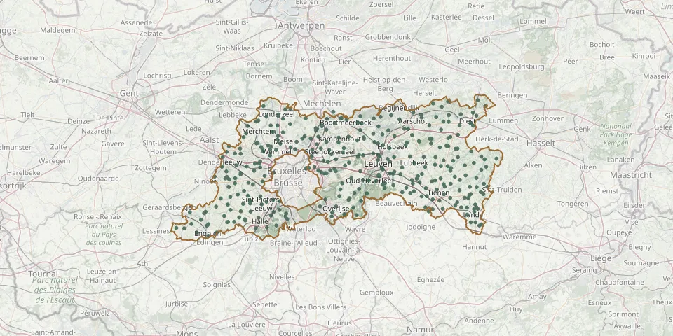 © OpenStreetMap
- Onze Lieve Vrouwekerk, LombeekGPS coordinates: 50.82211° N, 4.11417° E
- Onze Lieve Vrouwkerk van HuldenbergGPS coordinates: 50.78992° N, 4.58392° E
- Maleizen ChurchyardGPS coordinates: 50.74880° N, 4.51840° E
- Korbeek-Dijle ChurchyardGPS coordinates: 50.83932° N, 4.64112° E
- Neerijse ChurchyardGPS coordinates: 50.81720° N, 4.62550° E
- Moorsel CemeteryGPS coordinates: 50.86070° N, 4.53350° E
- Breedhout CemeteryGPS coordinates: 50.76101° N, 4.20035° E
- Sint Catharinakerk, HumelgemGPS coordinates: 50.90280° N, 4.51705° E
- Onze Lieve Vrouwkerk, BellingenGPS coordinates: 50.74643° N, 4.15547° E
- Leuven Missionary Sisters' CemeteryGPS coordinates: 50.84942° N, 4.70089° E
- Sint-Pieters-Kapelle Urn GravesGPS coordinates: 50.70838° N, 3.98980° E
- Aarschot Communal CemeteryGPS coordinates: 51.00548° N, 4.83727° E
- St. Martin Churchyard, LubbeekGPS coordinates: 50.88102° N, 4.84201° E
- Bogaarden CemeteryGPS coordinates: 50.73546° N, 4.13597° E
- Willebringen ChurchyardGPS coordinates: 50.80640° N, 4.82590° E
- Boutersem ChurchyardGPS coordinates: 50.83880° N, 4.83207° E
- OUDENAKEN CemeteryGPS coordinates: 50.78081° N, 4.19900° E
- Tombeek CemeteryGPS coordinates: 50.75450° N, 4.56790° E
- Betekom Communal CemeteryGPS coordinates: 50.98883° N, 4.78328° E
- Onze-Lieve-Vrouw-Lombeek CemeteryGPS coordinates: 50.82148° N, 4.11494° E
- Pellenberg CemeteryGPS coordinates: 50.87030° N, 4.79400° E
- Vertrijk ChurchyardGPS coordinates: 50.83050° N, 4.83540° E
- Neervelp ChurchyardGPS coordinates: 50.82011° N, 4.81039° E
- Sint-Bernardus Churchyard, HeikruisGPS coordinates: 50.73518° N, 4.11174° E
- Terlanen ChurchyardGPS coordinates: 50.77040° N, 4.60300° E
- Opvelp CemeteryGPS coordinates: 50.80890° N, 4.79450° E
- Park Abbey Cemetery, LeuvenGPS coordinates: 50.86537° N, 4.71751° E
- Onze Lieve Vrouwekerk, GaasbeekGPS coordinates: 50.80016° N, 4.18948° E
- Sint-Amandus Churchyard, ElingenGPS coordinates: 50.77963° N, 4.17094° E
- Wilsele ChurchyardGPS coordinates: 50.89688° N, 4.70326° E