
Flemish Brabant
352 known cemeteries in Flemish Brabant, Belgium.
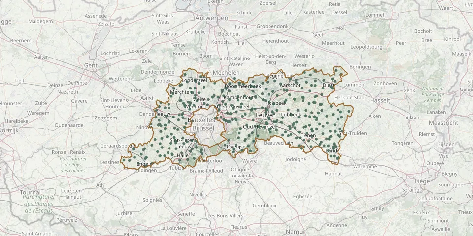 © OpenStreetMap
- Groot-Bijgaarden Don Bosco CemeteryGPS coordinates: 50.87009° N, 4.23814° E
- Grootlo CemeteryGPS coordinates: 51.01096° N, 4.70755° E
- Gussenhoven CemeteryGPS coordinates: 50.80225° N, 5.05957° E
- Haacht Communal CemeteryGPS coordinates: 50.97885° N, 4.63555° E
- Halle CemeteryGPS coordinates: 50.80444° N, 5.11220° E
- Halle Communal CemeteryGPS coordinates: 50.74491° N, 4.23191° E
- Hamme LindestraatGPS coordinates: 50.91390° N, 4.27600° E
- Heienbeek ChurchyardGPS coordinates: 50.94143° N, 4.40232° E
- Heikruis CemeteryGPS coordinates: 50.73460° N, 4.10920° E
- Hekelgem CemeteryGPS coordinates: 50.90880° N, 4.10576° E
- Herent Center Communal CemeteryGPS coordinates: 50.90462° N, 4.68064° E
- Herhout CemeteryGPS coordinates: 50.73024° N, 3.96853° E
- Herne CemeteryGPS coordinates: 50.72969° N, 4.03432° E
- Heverlee Annunciate Sisters Convent ChurchyardGPS coordinates: 50.85194° N, 4.70250° E
- Heverlee, Cemetery De JachtGPS coordinates: 50.84875° N, 4.70625° E
- Hever Municipal CemeteryGPS coordinates: 50.99047° N, 4.55185° E
- Hoeleden CemeteryGPS coordinates: 50.86217° N, 4.98334° E
- Hoeleden Old CemeteryGPS coordinates: 50.86836° N, 4.98595° E
- Hofstade CemeteryGPS coordinates: 50.99020° N, 4.49890° E
- Hoksem CemeteryGPS coordinates: 50.83830° N, 4.92390° E
- Hoksem ChurchyardGPS coordinates: 50.79824° N, 4.87047° E
- Holsbeek CemeteryGPS coordinates: 50.91809° N, 4.74388° E
- Houtem ChurchyardGPS coordinates: 50.94627° N, 4.46552° E
- Houwaart Church CemeteryGPS coordinates: 50.93446° N, 4.86080° E
- Houwaart Molenstraat CemeteryGPS coordinates: 50.93562° N, 4.85987° E
- Huizingen CemeteryGPS coordinates: 50.75089° N, 4.28036° E
- Huldenberg CemeteryGPS coordinates: 50.79400° N, 4.58805° E
- Imde ChurchyardGPS coordinates: 50.97381° N, 4.30593° E
- Itterbeek CemeteryGPS coordinates: 50.83565° N, 4.24707° E
- Jezus-Eik CemeteryGPS coordinates: 50.79079° N, 4.49308° E