
Limburg
316 known cemeteries in Limburg, Belgium.
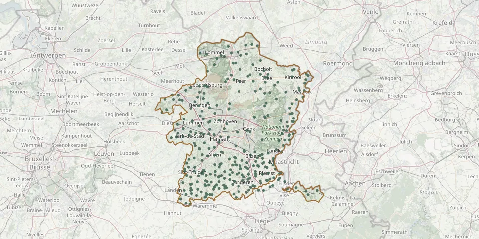 © OpenStreetMap
- Opgrimbie CemeteryGPS coordinates: 50.94854° N, 5.68169° E
- Opheers ChurchyardGPS coordinates: 50.73710° N, 5.29350° E
- Ophoven CemeteryGPS coordinates: 51.12507° N, 5.80499° E
- Opitter CemeteryGPS coordinates: 51.11784° N, 5.64058° E
- Opoeteren CemeteryGPS coordinates: 51.06995° N, 5.64975° E
- Overpelt-Fabriek CemeteryGPS coordinates: 51.22881° N, 5.39968° E
- Overrepen ChurchyardGPS coordinates: 50.80822° N, 5.43100° E
- Paal Cemetery (Sint-Jansstraat)GPS coordinates: 51.03800° N, 5.17760° E
- Peer Centre CemeteryGPS coordinates: 51.13147° N, 5.44558° E
- Piringen ChurchyardGPS coordinates: 50.78289° N, 5.41798° E
- Rekem Communal CemeteryGPS coordinates: 50.92678° N, 5.69671° E
- Rekem Psychiatric Hospital Historic CemeteryGPS coordinates: 50.92540° N, 5.66571° E
- Reppel ChurchyardGPS coordinates: 51.15498° N, 5.56146° E
- Riemst CemeteryGPS coordinates: 50.81048° N, 5.60473° E
- Rijkel CemeteryGPS coordinates: 50.80360° N, 5.26150° E
- Rijkhoven CemeteryGPS coordinates: 50.83799° N, 5.52402° E
- Romershoven ChurchyardGPS coordinates: 50.85600° N, 5.46153° E
- Rosmeer Cemetery, DiepestraatGPS coordinates: 50.84890° N, 5.57970° E
- Rosmeer Cemetery, KerkstraatGPS coordinates: 50.84610° N, 5.57490° E
- Rotem CemeteryGPS coordinates: 51.05370° N, 5.73566° E
- Rukkelingen CemeteryGPS coordinates: 50.73009° N, 5.25989° E
- Runkelen CemeteryGPS coordinates: 50.84690° N, 5.15410° E
- Schakkebroek ChurchyardGPS coordinates: 50.90680° N, 5.20240° E
- Schalkhoven ChurchyardGPS coordinates: 50.83751° N, 5.44912° E
- Schoot CemeteryGPS coordinates: 51.06944° N, 5.03553° E
- Schulen CemeteryGPS coordinates: 50.95573° N, 5.17598° E
- 's-Herenelderen CemeteryGPS coordinates: 50.80747° N, 5.49687° E
- Sint-AgapituskerkGPS coordinates: 50.84020° N, 5.42890° E
- Sint-AldegondiskerkGPS coordinates: 51.00860° N, 5.58560° E
- Sint-Amanduskerk (Zammelen)GPS coordinates: 50.81390° N, 5.40620° E