
Santa Catarina
1,559 known cemeteries in Santa Catarina, Brazil.
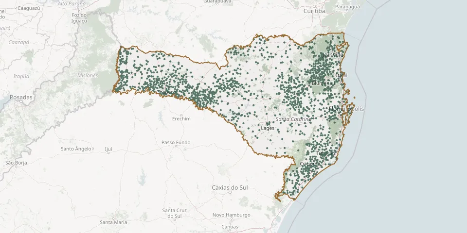 © OpenStreetMap
- Bethel Evangelical CemeteryGPS coordinates: 29.20611° S, 49.75454° W
- Biguaçu CemeteryGPS coordinates: 27.51782° S, 48.76392° W
- Biguaçu Municipal CemeteryGPS coordinates: 27.50730° S, 48.65602° W
- Biguaçú Municipal CemeteryGPS coordinates: 26.96425° S, 49.07352° W
- Bituvinha CemeteryGPS coordinates: 26.29167° S, 49.63955° W
- Blumenau Lutheran CemeteryGPS coordinates: 26.92615° S, 49.05494° W
- Boa Esperança CemeteryGPS coordinates: 26.91003° S, 52.26045° W
- Boa Vista CemeteryGPS coordinates: 28.80923° S, 49.28460° W
- Boa Vista CemeteryGPS coordinates: 27.14089° S, 51.74931° W
- Bocaina do Sul CemeteryGPS coordinates: 27.74805° S, 49.95212° W
- Bombinhas Municipal CemeteryGPS coordinates: 27.14761° S, 48.49775° W
- Bom Jardim da Serra Municipal CemeteryGPS coordinates: 28.33893° S, 49.63600° W
- Bom Jesus CemeteryGPS coordinates: 28.23246° S, 48.97130° W
- Bom Jesus CemeteryGPS coordinates: 26.74377° S, 52.39708° W
- Bom Jesus CemeteryGPS coordinates: 27.62860° S, 50.62531° W
- Bom Jesus Cemetery near SC-155GPS coordinates: 26.70645° S, 52.36168° W
- Bom Jesus Cemetery, Rua Bom Pastor, SchroederGPS coordinates: 26.38748° S, 49.09996° W
- Bom Jesus Church CemeteryGPS coordinates: 27.64886° S, 48.85345° W
- Bom Jesus Churchyard, LontrasGPS coordinates: 27.14731° S, 49.52717° W
- Bom Jesus do Oeste Municipal CemeteryGPS coordinates: 26.70151° S, 53.09924° W
- Bom Pastor Chapel Lutheran Cemetery, MassarandubaGPS coordinates: 26.57415° S, 48.92588° W
- Bom Pastor Lutheran Cemetery, BrusqueGPS coordinates: 27.09584° S, 48.91761° W
- Bom Retiro CemeteryGPS coordinates: 26.31116° S, 50.75399° W
- Bom Retiro Central CemeteryGPS coordinates: 27.79307° S, 49.48760° W
- Bom Sucesso Catholic CemeteryGPS coordinates: 26.98293° S, 51.32505° W
- Bonito Community CemeteryGPS coordinates: 26.99310° S, 52.17629° W
- Borboleta Alta CemeteryGPS coordinates: 27.22041° S, 52.35493° W
- Botuverá Municipal CemeteryGPS coordinates: 27.19823° S, 49.07253° W
- Bracatinga Community CemeteryGPS coordinates: 27.10829° S, 51.17986° W
- Braço do Norte Municipal CemeteryGPS coordinates: 28.27477° S, 49.15222° W