
Brandenburg
2,113 known cemeteries in Brandenburg, Germany.
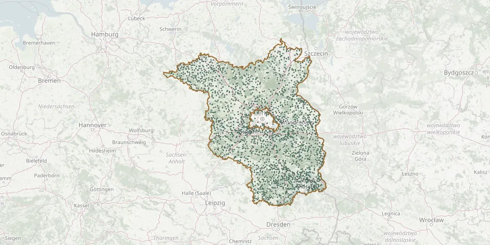 © OpenStreetMap
- Klepzig CemeteryGPS coordinates: 52.01775° N, 12.53284° E
- Kleßen CemeteryGPS coordinates: 52.73906° N, 12.49765° E
- Klettwitz CemeteryGPS coordinates: 51.53704° N, 13.89844° E
- Kletzke CemeteryGPS coordinates: 52.99738° N, 12.05080° E
- Kliestow CemeteryGPS coordinates: 52.36771° N, 14.50687° E
- Kliestow CemeteryGPS coordinates: 52.20021° N, 13.20951° E
- Klinkow CemeteryGPS coordinates: 53.33700° N, 13.80851° E
- Klosterdorf CemeteryGPS coordinates: 52.59050° N, 13.95050° E
- Klosterheide CemeteryGPS coordinates: 52.98977° N, 12.97110° E
- Kloster Lehnin Woodland CemeteryGPS coordinates: 52.31191° N, 12.74465° E
- Kloster Zinna CemeteryGPS coordinates: 52.02586° N, 13.10244° E
- Knippelsdorf CemeteryGPS coordinates: 51.82291° N, 13.34481° E
- Knoblauch CemeteryGPS coordinates: 52.44893° N, 12.35088° E
- Knoblauch Former CemeteryGPS coordinates: 52.50481° N, 12.86636° E
- Kobbeln CemeteryGPS coordinates: 52.10012° N, 14.56487° E
- Kohlsdorf CemeteryGPS coordinates: 52.16212° N, 14.19714° E
- Kolkwitz CemeteryGPS coordinates: 51.76090° N, 14.25036° E
- Kolochau CemeteryGPS coordinates: 51.72658° N, 13.31856° E
- Kolonie Vorheide Jewish CemeteryGPS coordinates: 52.16389° N, 14.22000° E
- Kolrep CemeteryGPS coordinates: 53.02917° N, 12.28326° E
- Kölsa CemeteryGPS coordinates: 51.58223° N, 13.20908° E
- Kolzenburg CemeteryGPS coordinates: 52.06110° N, 13.15995° E
- Komptendorf CemeteryGPS coordinates: 51.68564° N, 14.47306° E
- Königs Wusterhausen CemeteryGPS coordinates: 52.30006° N, 13.61997° E
- Könkendorf CemeteryGPS coordinates: 53.18422° N, 12.30008° E
- Köpernitz CemeteryGPS coordinates: 52.24613° N, 12.30955° E
- Koppatz CemeteryGPS coordinates: 51.69604° N, 14.43174° E
- Koppelweg CemeteryGPS coordinates: 52.44630° N, 13.43061° E
- Körba CemeteryGPS coordinates: 51.81133° N, 13.38735° E
- Köritz CemeteryGPS coordinates: 52.84328° N, 12.44071° E