
Saxony
1,500 known cemeteries in Saxony, Germany.
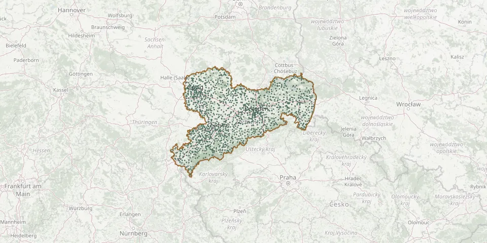 © OpenStreetMap
- Bannewitz CemeteryGPS coordinates: 50.99699° N, 13.72037° E
- Geithain CemeteryGPS coordinates: 51.05685° N, 12.68816° E
- Heidenau-Süd CemeteryGPS coordinates: 50.96742° N, 13.86646° E
- Lützschena CemeteryGPS coordinates: 51.38166° N, 12.28403° E
- Hohnstein CemeteryGPS coordinates: 50.97877° N, 14.11602° E
- Ehrenberg CemeteryGPS coordinates: 50.99158° N, 14.15248° E
- Lobstädt CemeteryGPS coordinates: 51.13365° N, 12.45571° E
- Briesnitz Inner CemeteryGPS coordinates: 51.06750° N, 13.67170° E
- Lockwitzer CemeteryGPS coordinates: 50.98500° N, 13.80490° E
- Arnsdorf CemeteryGPS coordinates: 51.09663° N, 13.99484° E
- Leippe CemeteryGPS coordinates: 51.42270° N, 14.07381° E
- Friedrichstadt New Catholic CemeteryGPS coordinates: 51.06140° N, 13.70080° E
- Kühnhaide CemeteryGPS coordinates: 50.58772° N, 13.24419° E
- Espenhain CemeteryGPS coordinates: 51.19202° N, 12.46491° E
- Weixdorf CemeteryGPS coordinates: 51.15497° N, 13.80950° E
- Ralbičanski kěrchowGPS coordinates: 51.30222° N, 14.24621° E
- Leipzig-Gohlis CemeteryGPS coordinates: 51.37171° N, 12.36731° E
- Oybin Mountain CemeteryGPS coordinates: 50.84410° N, 14.74200° E
- Ruppersdorf CemeteryGPS coordinates: 50.99679° N, 14.72297° E
- Burkersdorf Woodland CemeteryGPS coordinates: 50.92285° N, 12.79872° E
- Dolsenhain CemeteryGPS coordinates: 51.01270° N, 12.56888° E
- Krostitz CemeteryGPS coordinates: 51.46072° N, 12.45524° E
- 1 Oberoderwitz CemeteryGPS coordinates: 50.97158° N, 14.70127° E
- Dresden Municipal Heath CemeteryGPS coordinates: 51.10244° N, 13.70573° E
- Stadt Wehlen Evangelical Lutheran CemeteryGPS coordinates: 50.95576° N, 14.02552° E
- Zwönitz CemeteryGPS coordinates: 50.62902° N, 12.81277° E
- Eschefeld CemeteryGPS coordinates: 51.03714° N, 12.51993° E
- Rathewalde CemeteryGPS coordinates: 50.98278° N, 14.07486° E
- Reitzenhain CemeteryGPS coordinates: 50.56451° N, 13.21649° E
- Staritz CemeteryGPS coordinates: 51.44410° N, 13.17136° E