
Saxony
1,500 known cemeteries in Saxony, Germany.
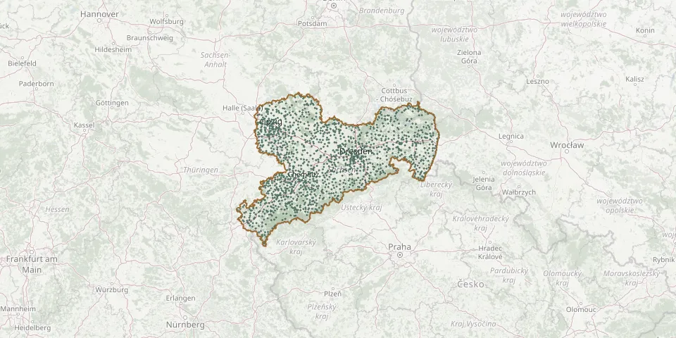 © OpenStreetMap
- Alberoda CemeteryGPS coordinates: 50.61448° N, 12.70737° E
- Albrechtshain CemeteryGPS coordinates: 51.30282° N, 12.56698° E
- Altenbach CemeteryGPS coordinates: 51.35161° N, 12.67857° E
- Altenberg Urn GroveGPS coordinates: 50.76395° N, 13.76918° E
- Altenhain CemeteryGPS coordinates: 51.29234° N, 12.69809° E
- Altensalz CemeteryGPS coordinates: 50.51327° N, 12.22178° E
- Althen CemeteryGPS coordinates: 51.33906° N, 12.51936° E
- Altmannsgrün CemeteryGPS coordinates: 50.51468° N, 12.28612° E
- Altmörbitz CemeteryGPS coordinates: 50.99364° N, 12.57036° E
- Altmügeln CemeteryGPS coordinates: 51.24014° N, 13.03534° E
- Altoschatz CemeteryGPS coordinates: 51.28967° N, 13.09749° E
- Altpenig CemeteryGPS coordinates: 50.93658° N, 12.70400° E
- Altranstädt CemeteryGPS coordinates: 51.31459° N, 12.17100° E
- Altscherbitz CemeteryGPS coordinates: 51.39300° N, 12.22706° E
- Ammelshain CemeteryGPS coordinates: 51.29438° N, 12.63543° E
- Annaberg-Buchholz CemeteryGPS coordinates: 50.59332° N, 13.01111° E
- Annen New Cemetery, DresdenGPS coordinates: 51.04290° N, 13.69560° E
- Arnoldsgrün CemeteryGPS coordinates: 50.40923° N, 12.27659° E
- Arnsdorf CemeteryGPS coordinates: 51.19621° N, 14.78806° E
- Arnsfeld CemeteryGPS coordinates: 50.57724° N, 13.11878° E
- Arnsgrün CemeteryGPS coordinates: 50.31202° N, 12.22547° E
- Arzberg Village Church and ChurchyardGPS coordinates: 51.52768° N, 13.12532° E
- Audenhain Evangelical CemeteryGPS coordinates: 51.50120° N, 12.85900° E
- Audigast CemeteryGPS coordinates: 51.17240° N, 12.28894° E
- Aue CemeteryGPS coordinates: 50.59842° N, 12.69270° E
- Aue Park Cemetery, formerly St. Nicholas CemeteryGPS coordinates: 50.57978° N, 12.71003° E
- Auerbach CemeteryGPS coordinates: 50.73777° N, 12.52940° E
- Auerbach CemeteryGPS coordinates: 50.51734° N, 12.40750° E
- Auerbach CemeteryGPS coordinates: 50.68640° N, 12.91237° E
- Auerswalde CemeteryGPS coordinates: 50.90182° N, 12.91387° E