
Saxony
1,500 known cemeteries in Saxony, Germany.
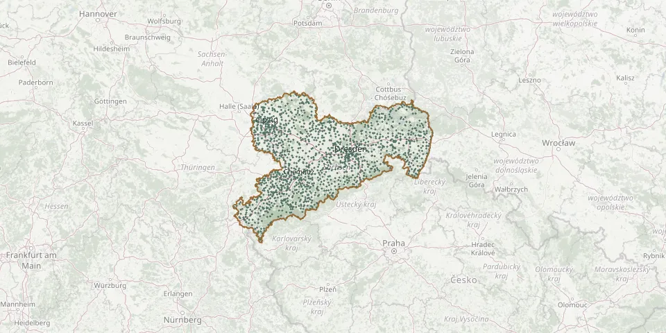 © OpenStreetMap
- Zedtlitz CemeteryGPS coordinates: 51.10216° N, 12.51489° E
- Berthelsdorf CemeteryGPS coordinates: 51.02977° N, 14.76084° E
- Drebligar ChurchyardGPS coordinates: 51.62750° N, 12.91340° E
- Dreiskau-Muckern CemeteryGPS coordinates: 51.21888° N, 12.46776° E
- Görlitz Jewish Community CemeteryGPS coordinates: 51.14170° N, 14.96737° E
- Graupa CemeteryGPS coordinates: 50.99244° N, 13.92416° E
- Neukirchen CemeteryGPS coordinates: 51.08325° N, 12.52867° E
- Kesselsdorf Old CemeteryGPS coordinates: 51.03091° N, 13.59634° E
- Schlegel CemeteryGPS coordinates: 50.97987° N, 14.87391° E
- St. Nicholas Cemetery, GörlitzGPS coordinates: 51.16013° N, 14.98790° E
- Breitenbrunn CemeteryGPS coordinates: 50.47647° N, 12.77241° E
- Döhlen CemeteryGPS coordinates: 51.00828° N, 13.64884° E
- Gröba ChurchyardGPS coordinates: 51.32183° N, 13.28666° E
- Kottmar CemeteryGPS coordinates: 51.05467° N, 14.65419° E
- Obercunnersdorf CemeteryGPS coordinates: 51.03531° N, 14.67245° E
- Oberschaar Cemetery (Halsbrücke)GPS coordinates: 50.98069° N, 13.40840° E
- Olbernhau CemeteryGPS coordinates: 50.65848° N, 13.32654° E
- St. John Old Cemetery, LeipzigGPS coordinates: 51.33700° N, 12.38928° E
- Weißenborner CemeteryGPS coordinates: 50.73548° N, 12.47317° E
- Bischofswerda New CemeteryGPS coordinates: 51.13108° N, 14.19707° E
- Frohburg Old CemeteryGPS coordinates: 51.05404° N, 12.55402° E
- Königstein CemeteryGPS coordinates: 50.91597° N, 14.07033° E
- Markersdorf CemeteryGPS coordinates: 51.14273° N, 14.88070° E
- Pöblitzer CemeteryGPS coordinates: 50.74229° N, 12.50644° E
- Zinnwald-GeorgenfeldGPS coordinates: 50.73616° N, 13.76083° E
- Ablaß CemeteryGPS coordinates: 51.22591° N, 12.94684° E
- Adelsberg CemeteryGPS coordinates: 50.81331° N, 12.99159° E
- Adorf CemeteryGPS coordinates: 50.75184° N, 12.87548° E
- Affalter CemeteryGPS coordinates: 50.64595° N, 12.75881° E
- Albernau CemeteryGPS coordinates: 50.54792° N, 12.65890° E